Hello, world! I realize I've failed at the day-to-day writeup of AGU that I promised back in December (eep), but what better way to come back from an unannounced work-induced hiatus than to describe the work I've been doing, hm?
I don't think I've blogged much about the research I do. I know I post about about interesting places I visit, visible and tangible fault features, and outreach, but my actual research doesn't have a field component yet at all. I do work in earthquake dynamics - the physics of how faults rupture. My method so far has been numerical modeling, specifically with both 2d and 3d finite element codes. This method divides both sides of the fault into a grid of elements of a designated size, then applies equations of motion, stress transfer, and wave propagation to each element over each timestep, then sums up the result. Each model represents a single earthquake on a fault; aside from a forced nucleation point, the magnitude and intensity of the quake are determined by the model parameters. There are many existing codes that do this, and I've been working with two of the newer ones. I've also very recently started doing some multi-cycle quasi-dynamic models. These take a fault system and put it through multiple earthquake cycles, including interseismic application of tectonic stresses. What makes them quasi-dynamic is the ruptures work by way of stress state, and don't include dynamic wave propagation.
There are a lot of fault parameters you can tweak in dynamic models, and my work focuses on the effects of fault geometry on rupture behavior and ground motion. Models investigating other parameters might use a fault that's a straight line, but straight lines almost never happen in nature. Faults have branches, bends, discontinuities, and stepovers, and they've proven to be important factors in determining where earthquake rupture stops. There's one field study of mapped surface ruptures (Wesnousky, 2008) that shows that a significant number of surface ruptures die out near a geometrical discontinuity in the mapped fault trace. On the other hand, events like the 1992 Landers earthquake or the 2002 Denali earthquake show that rupture can traverse some considerable discontinuities between faults. Understanding how rupture behaves when it encounters a geometrical discontinuity is therefore very important in determining the hazard associated with individual faults or fault systems.
I already have one fault geometry paper (which also happens to be the first chapter of my Master's thesis) in review. It's a parameter study of whether or not rupture will propagate through a bend in a fault of a given length, with a given connecting angle. Unsurprisingly, steeper angles and longer bends are more likely to halt a rupture, but exactly how steep or long varies depending on whether the step is extensional or compressional (that is, whether the bent segment is pulled apart by the fault's direction of slip, or whether it's crunched together), on the overall size of the fault system, and on the orientation of the stress field acting on the fault. That third criterion is particularly important - in some orientation, dynamic effects control the rupture far more than static ones, but in others, static effects can overcome dynamic ones. I still haven't heard from any reviewers on this paper, but I'm sure I'll post here excitedly when it goes into press.
I'm working on a second paper now, determining how fault geometry affects the intensity and distribution of peak ground motion in an earthquake. In this case, I'm using fault systems that consist of two segments with no linking segment, meaning that rupture has to re-nucleate on the second segment as opposed to just traversing an unfavorable part. I'm looking at both compressional and extensional systems here, with a varied distance between the fault segments, a variety of stress drops, a variety of rupture velocities, and a variety of different rock types. So far, I'm finding that every single one of those parameters affects the pattern and intensity of motion. The talk I gave at AGU (which I will write about, really!) was about preliminary results of this work, and I'll be giving a talk at the Seismological Society of America meeting in Portland in April about the specifics of the material contrast cases.
So that's my research - as I transition into working on a PhD, I'll start investigating more complex geometries and looking at real fault systems, as opposed to hypothetical ones. All that while still taking a bunch of classes to catch up on my background!
Showing posts with label accretionary wedge. Show all posts
Showing posts with label accretionary wedge. Show all posts
Friday, March 26, 2010

Thursday, June 18, 2009
Time Warp: Destination 1906
Lockwood had to poke me that the Accretionary Wedge is stumbling back to its feet, but it was good timing for a poke, since the quarter has just ended, and I might actually have time to write things other than comments on the undergrad papers I've been grading. (More on my insane past quarter later.) Anyway, I was initially concerned that I wouldn't be able to think of a topic and come up with an even vaguely eloquent post by the end of the grace period for late entries.
And then I saw the actual topic. No need to brainstorm here! I'm sure that every single one of you who has followed my blog, sparse though it's been lately, knows where and when I'd take my time machine. My choice definitely does not, however, come from any sort of desire to watch the destruction of a major city and the combustion of thousands of lives within. The decision to set the time machine for San Francisco in April of 1906 comes from an intense interest in earthquakes as events and processes, a great love for the city in question, and a fascination with the development of the field of earthquake physics itself.
I'll admit right out that I am curious what it feels like to be in a M7.8 earthquake. So far, my personal experience maxes out at M5.4, which was entirely exciting and not at all terrifying in my book. I suspect M7.8 would be well past the boundary between excitement and fear, but I suppose I wouldn't be afraid of the idea of that fear if I were gearing up my time machine to experience it. Furthermore, the bigger quakes are the ones that get the most intensive study, and while my own models are currently producing things that, according to the length of the faults, might not top the mid-6 range, I'll eventually be dealing in 7-pointers, and I want to know what one is like. For this curiosity, a time machine is a preferable option to waiting for a real one, both because it eliminates the waiting to begin with, and also because it means we wouldn't need a new 7.8 to appease any seismologist who might have this same curiosity. Of course, there's bound to be another one sooner than later, geologically-speaking, but the longer we put the new one off, the more we come to know about the processes behind it, and the more we can prepare our cities and citizens. The old quake already did its damage, horrendous though it was.
And that brings me to another point - I would not want to be in San Francisco proper to experience this earthquake. Even if my time machine were to make me impervious to flying bricks and walls of flame, I'd still want to be waiting somewhere where I could see the fault rip its way down the peninsula. I once read an account of a woman in Idaho who watched a fault rip through her property. She described it as if the fault scarp were being painted across the landscape by a very fast brush. That definitely seems like some sort of juncture between fear and awe, and that is absolutely something I'd want to see. My odds of merely experiencing a non-anachronistic 7.8 are much higher than of me watching the fault break in the process of creating that 7.8. Once the rupture passed me by, however, I think I would want to get back to the City as fast as possible, to see what damage the earthquake alone did before the fires took over...and then I'd want to get back to safer ground quite quickly as well, to avoid being caught by the flames.
But I could see a surface rupture for so many other earthquakes. Why turn my time machine toward this one? That, I'll admit, comes from my feeling extremely attached to San Francisco - never mind that I've never lived there! In making my plans to jaunt back 103 years, I'd build in a little extra time before April 18th - maybe I'd show up at the beginning of the month - so that I could explore the old San Francisco before it got wiped off the map. There are plenty of words about it, but in describing the before and after case, whose prose wouldn't be biased by what they'd just gone through? And, of course, who would have known to take before photos, if they had no reason to expect an after? The 1906 earthquake might have been the first extensively photographed natural disaster, but pre-quake images are hard to come by. I'd want to spend time just wandering the place, as I explore places when I visit them now, getting to know the streets and buildings and characters as they were before their disruption. If I were allowed modern technology aside from my time machine, I might try to snap some photos. If not, I'd plan to blow through a sketchbook or two. I might also be tempted to try and get a seat (or, more likely, a place to stand in the gallery) at the infamous Metropolitan Opera showing of Bizet's Carmen on the evening of April 17th, both because of the infamy of the event, but also because I am still a music geek, switch of majors or not! I've never seen Carmen live, and were I to have the opportunity to see Caruso in it, well, that's an excitement I'd share with many of those 1906 San Franciscans. It might even be a strange way to lose track of my hindsight for a few hours - just so long as I was sure to get it back in time to get out to the fault trace!
When I say that I'd want to get out of danger in the City once the fire started, though, I do not mean I wish to zap myself immediately back to 2009. I would be willing to handle the discomfort of the survivor camps for the sake of historical and cultural understanding, but also as a way to wait for the less ominous aftermath. Before the 1906 earthquake, so very little was known about faults and how they work, and the still-nameless San Andreas Fault was thought to be a small discontinuity in rock type not extending beyond part of San Mateo County. I would love to get myself an in with the scientific community of the day and watch the progression from knowing nothing of the earthquake source to "do the earthquakes cause the faults, or do the faults cause the earthquakes?" to the oh-so-fundamental elastic rebound theory. I would be so excited to watch the faults of California get drawn in on the map for the first time, outlining mountain ranges, bounding geologic provinces, highlighting the network of hazard that we still strive to understand and mitigate today. And to be able to witness that while also observing the rebuilding of San Francisco...Definitely a time of wonder and excitement, even though it came out of tragedy.
I suppose that all means I'd be staying until 1910. A bit of an extended trip, in terms of humanity, but not even a blink in geologic time. And since a time machine could be set to return to the exact time and place from whence it came, it wouldn't even be a blink at all to the current world that includes my timeline. It might mean four years off from my research, but I'd come back from it with a closer connection to where what I'm doing comes from, both in terms of scientific roots and in terms of seeing first hand what these natural processes we study can do.
And then I saw the actual topic. No need to brainstorm here! I'm sure that every single one of you who has followed my blog, sparse though it's been lately, knows where and when I'd take my time machine. My choice definitely does not, however, come from any sort of desire to watch the destruction of a major city and the combustion of thousands of lives within. The decision to set the time machine for San Francisco in April of 1906 comes from an intense interest in earthquakes as events and processes, a great love for the city in question, and a fascination with the development of the field of earthquake physics itself.
I'll admit right out that I am curious what it feels like to be in a M7.8 earthquake. So far, my personal experience maxes out at M5.4, which was entirely exciting and not at all terrifying in my book. I suspect M7.8 would be well past the boundary between excitement and fear, but I suppose I wouldn't be afraid of the idea of that fear if I were gearing up my time machine to experience it. Furthermore, the bigger quakes are the ones that get the most intensive study, and while my own models are currently producing things that, according to the length of the faults, might not top the mid-6 range, I'll eventually be dealing in 7-pointers, and I want to know what one is like. For this curiosity, a time machine is a preferable option to waiting for a real one, both because it eliminates the waiting to begin with, and also because it means we wouldn't need a new 7.8 to appease any seismologist who might have this same curiosity. Of course, there's bound to be another one sooner than later, geologically-speaking, but the longer we put the new one off, the more we come to know about the processes behind it, and the more we can prepare our cities and citizens. The old quake already did its damage, horrendous though it was.
And that brings me to another point - I would not want to be in San Francisco proper to experience this earthquake. Even if my time machine were to make me impervious to flying bricks and walls of flame, I'd still want to be waiting somewhere where I could see the fault rip its way down the peninsula. I once read an account of a woman in Idaho who watched a fault rip through her property. She described it as if the fault scarp were being painted across the landscape by a very fast brush. That definitely seems like some sort of juncture between fear and awe, and that is absolutely something I'd want to see. My odds of merely experiencing a non-anachronistic 7.8 are much higher than of me watching the fault break in the process of creating that 7.8. Once the rupture passed me by, however, I think I would want to get back to the City as fast as possible, to see what damage the earthquake alone did before the fires took over...and then I'd want to get back to safer ground quite quickly as well, to avoid being caught by the flames.
But I could see a surface rupture for so many other earthquakes. Why turn my time machine toward this one? That, I'll admit, comes from my feeling extremely attached to San Francisco - never mind that I've never lived there! In making my plans to jaunt back 103 years, I'd build in a little extra time before April 18th - maybe I'd show up at the beginning of the month - so that I could explore the old San Francisco before it got wiped off the map. There are plenty of words about it, but in describing the before and after case, whose prose wouldn't be biased by what they'd just gone through? And, of course, who would have known to take before photos, if they had no reason to expect an after? The 1906 earthquake might have been the first extensively photographed natural disaster, but pre-quake images are hard to come by. I'd want to spend time just wandering the place, as I explore places when I visit them now, getting to know the streets and buildings and characters as they were before their disruption. If I were allowed modern technology aside from my time machine, I might try to snap some photos. If not, I'd plan to blow through a sketchbook or two. I might also be tempted to try and get a seat (or, more likely, a place to stand in the gallery) at the infamous Metropolitan Opera showing of Bizet's Carmen on the evening of April 17th, both because of the infamy of the event, but also because I am still a music geek, switch of majors or not! I've never seen Carmen live, and were I to have the opportunity to see Caruso in it, well, that's an excitement I'd share with many of those 1906 San Franciscans. It might even be a strange way to lose track of my hindsight for a few hours - just so long as I was sure to get it back in time to get out to the fault trace!
When I say that I'd want to get out of danger in the City once the fire started, though, I do not mean I wish to zap myself immediately back to 2009. I would be willing to handle the discomfort of the survivor camps for the sake of historical and cultural understanding, but also as a way to wait for the less ominous aftermath. Before the 1906 earthquake, so very little was known about faults and how they work, and the still-nameless San Andreas Fault was thought to be a small discontinuity in rock type not extending beyond part of San Mateo County. I would love to get myself an in with the scientific community of the day and watch the progression from knowing nothing of the earthquake source to "do the earthquakes cause the faults, or do the faults cause the earthquakes?" to the oh-so-fundamental elastic rebound theory. I would be so excited to watch the faults of California get drawn in on the map for the first time, outlining mountain ranges, bounding geologic provinces, highlighting the network of hazard that we still strive to understand and mitigate today. And to be able to witness that while also observing the rebuilding of San Francisco...Definitely a time of wonder and excitement, even though it came out of tragedy.
I suppose that all means I'd be staying until 1910. A bit of an extended trip, in terms of humanity, but not even a blink in geologic time. And since a time machine could be set to return to the exact time and place from whence it came, it wouldn't even be a blink at all to the current world that includes my timeline. It might mean four years off from my research, but I'd come back from it with a closer connection to where what I'm doing comes from, both in terms of scientific roots and in terms of seeing first hand what these natural processes we study can do.
Wednesday, February 25, 2009
...and then two more.
I was tempted, in light of specific sentences said by a particular politician yesterday, to forgo my planned Accretionary Wedge post and instead write about how every geologist, at some point in his or her life, should engage in a little volcano monitoring. I totally stand by my statement (and will be taking a class next quarter that absolutely involves volcano monitoring), but I also recall that we're collectively trying to come with 100 things, and there is certainly enough room in the budget of geological curiosity/exploration for me to write about those things in addition to snarking about things that other members of the geoblogosphere have already addressed so eloquently.
And now, the post I was planning to write before this madness went down.
The original 100 Places Meme lists the San Andreas Fault as a Must-See. I absolutely agree with this, but as I was marking the text on the list in bold, I got to thinking about how those three words mean a whole slew of very different places, spread out over hundreds of miles. The ultimate San Andreas experience is, of course, to drive the whole thing (or, well, the parts that are on land). I can't check off the full 800 miles yet, but I've been from the southern end of the Fault at the Salton Sea up through Point Reyes, mostly on roads that cling pretty close to the surface trace. I definitely recommend this drive as a means to check off the San Andreas on the original meme, but I also feel like there are several specific must-see sites along its trace (and within its system of associate faults) that deserve space on the expanded list.
The first place that came to mind, without me even having to really think about it, is Carrizo Plain National Monument, in rural San Luis Obispo County. The quintessential image of the San Andreas, the one that pops up in all sorts of textbooks and popular science books about earthquakes, the first photo that turns up when one does a google image search for the San Andreas, is from the Carrizo. It's an aerial photo of the Elkhorn Scarp, also known as the Dragon's Backbone, a 17-mile-long pressure ridge that, from above, looks like a gaping chasm into the depths of the Earth. (The original Superman movie actually does use the scarp as Supes' entry point into the fault...) It is a spectacular photo, but the view from the ground is equally breathtaking, and has the added bonus of debunking the faults-as-gaping-chasms myth.
The Carrizo Plain is one of the best places to see a wide variety of features associated with continental strike-slip faults. In addition to the outstanding pressure ridge, there is the famous Wallace Creek. This streambed crosses the San Andreas, but not without getting pulled around a bit first. Wallace Creek takes a sharp right angle turn as it meets the Fault, then parallels it for some 130 feet before heading back on its course. This shows the displacement power that the San Andreas has, and is all the more staggering when taking into account that some people think a good percentage of that displacement came from the 1857 earthquake alone. There are plenty of other offset streambeds that are less dramatic, as well as some channels that have been "beheaded" by the fault. The Carrizo also boasts more typical scarps, some spots of more trenchlike fault expression, stepovers with traceable surface expression, and a few (mostly dry) sag ponds.

If faults aren't really your thing, the Carrizo Plain is still worth a visit. The northernmost part of the Plain contains Soda Lake, a huge alkaline lake out of which many spectacular mineral samples (some of which are in the Visitor's Center, which is not open all the time) have been extracted from not very deep. The Carrizo is also thought to be an example of what the native Californian landscape might have looked like before the Europeans did anything to it - fields dominated by wildflowers and scrubby plants. For this reason, late March and early April are the best time to visit, since the wildflowers are out in full force, and the entire Plain is painted in shades of green, yellow, orange, and blue. (Don't go in the middle of the summer, though, unless you like triple digit temperatures.)
The next place I want to add to the list doesn't strictly feature the San Andreas; the town of Hollister's bisector is the Calaveras Fault, though the Calaveras branches off from the San Andreas just south of the town. The seat of San Benito County may lack scenes of breathtaking beauty that could make even a non-geologist drool, but it's also one of the best places to see the bizarre California-centric phenomenon known as aseismic creep. Creep is a phenomenon in which a fault moves slowly and steadily at around the tectonic loading rate, constantly releasing stress in a way that does not radiate seismic waves and generally prohibits enough buildup to cause a large quake (though some creeping faults may have asperities within the creeping zone that still accumulate stress and rupture seismically, even though creep continues around that zone). The main place (if not the only - I haven't heard of it elsewhere) this has been observed is in California, specifically on the Hayward, Calaveras, and Rogers Creek Faults in the Bay Area, the San Andreas between Parkfield and San Juan Bautista, and the Superstition Hills Fault near the Mexican border.
Creep can be measured with all sorts of complex instrumentation, but its easiest for the layperson to see when some sort of manmade structure gets put on the fault, and proceeds to get bent and deflected and cracked. The cities of Santa Rosa, Berkeley, Hayward, Fremont, and others all have the trademark offset curbs of a creeping fault, but I personally think that Hollister is the best city to look for offset because it looks like they've put less effort (or money) into patching up the distortion. Some sidewalks are bent several feet out of line, many streets are crossed by sets of en echelon cracks, and some houses and garages have obvious bulges in the walls and cracks in the foundation.

So Hollister is a good place to see creep as a phenomenon in and of itself, but it's also a clear exhibition of the interaction between the Earth itself and its inhabitants, of how people keep living in some places in spite of the geology. I suspect the fault was not known to be there when Hollister was first founded, which could explain some of the spectacularly bad locations of houses, but towns like this can be an example of how the hazards of the landscape should be taken into account when planning future development.
Not to mention that such intersections of humanity and seismicity make it clear that Fault Monitoring is also pretty darn important...
And now, the post I was planning to write before this madness went down.
The original 100 Places Meme lists the San Andreas Fault as a Must-See. I absolutely agree with this, but as I was marking the text on the list in bold, I got to thinking about how those three words mean a whole slew of very different places, spread out over hundreds of miles. The ultimate San Andreas experience is, of course, to drive the whole thing (or, well, the parts that are on land). I can't check off the full 800 miles yet, but I've been from the southern end of the Fault at the Salton Sea up through Point Reyes, mostly on roads that cling pretty close to the surface trace. I definitely recommend this drive as a means to check off the San Andreas on the original meme, but I also feel like there are several specific must-see sites along its trace (and within its system of associate faults) that deserve space on the expanded list.
The first place that came to mind, without me even having to really think about it, is Carrizo Plain National Monument, in rural San Luis Obispo County. The quintessential image of the San Andreas, the one that pops up in all sorts of textbooks and popular science books about earthquakes, the first photo that turns up when one does a google image search for the San Andreas, is from the Carrizo. It's an aerial photo of the Elkhorn Scarp, also known as the Dragon's Backbone, a 17-mile-long pressure ridge that, from above, looks like a gaping chasm into the depths of the Earth. (The original Superman movie actually does use the scarp as Supes' entry point into the fault...) It is a spectacular photo, but the view from the ground is equally breathtaking, and has the added bonus of debunking the faults-as-gaping-chasms myth.
The Carrizo Plain is one of the best places to see a wide variety of features associated with continental strike-slip faults. In addition to the outstanding pressure ridge, there is the famous Wallace Creek. This streambed crosses the San Andreas, but not without getting pulled around a bit first. Wallace Creek takes a sharp right angle turn as it meets the Fault, then parallels it for some 130 feet before heading back on its course. This shows the displacement power that the San Andreas has, and is all the more staggering when taking into account that some people think a good percentage of that displacement came from the 1857 earthquake alone. There are plenty of other offset streambeds that are less dramatic, as well as some channels that have been "beheaded" by the fault. The Carrizo also boasts more typical scarps, some spots of more trenchlike fault expression, stepovers with traceable surface expression, and a few (mostly dry) sag ponds.

If faults aren't really your thing, the Carrizo Plain is still worth a visit. The northernmost part of the Plain contains Soda Lake, a huge alkaline lake out of which many spectacular mineral samples (some of which are in the Visitor's Center, which is not open all the time) have been extracted from not very deep. The Carrizo is also thought to be an example of what the native Californian landscape might have looked like before the Europeans did anything to it - fields dominated by wildflowers and scrubby plants. For this reason, late March and early April are the best time to visit, since the wildflowers are out in full force, and the entire Plain is painted in shades of green, yellow, orange, and blue. (Don't go in the middle of the summer, though, unless you like triple digit temperatures.)
The next place I want to add to the list doesn't strictly feature the San Andreas; the town of Hollister's bisector is the Calaveras Fault, though the Calaveras branches off from the San Andreas just south of the town. The seat of San Benito County may lack scenes of breathtaking beauty that could make even a non-geologist drool, but it's also one of the best places to see the bizarre California-centric phenomenon known as aseismic creep. Creep is a phenomenon in which a fault moves slowly and steadily at around the tectonic loading rate, constantly releasing stress in a way that does not radiate seismic waves and generally prohibits enough buildup to cause a large quake (though some creeping faults may have asperities within the creeping zone that still accumulate stress and rupture seismically, even though creep continues around that zone). The main place (if not the only - I haven't heard of it elsewhere) this has been observed is in California, specifically on the Hayward, Calaveras, and Rogers Creek Faults in the Bay Area, the San Andreas between Parkfield and San Juan Bautista, and the Superstition Hills Fault near the Mexican border.
Creep can be measured with all sorts of complex instrumentation, but its easiest for the layperson to see when some sort of manmade structure gets put on the fault, and proceeds to get bent and deflected and cracked. The cities of Santa Rosa, Berkeley, Hayward, Fremont, and others all have the trademark offset curbs of a creeping fault, but I personally think that Hollister is the best city to look for offset because it looks like they've put less effort (or money) into patching up the distortion. Some sidewalks are bent several feet out of line, many streets are crossed by sets of en echelon cracks, and some houses and garages have obvious bulges in the walls and cracks in the foundation.

So Hollister is a good place to see creep as a phenomenon in and of itself, but it's also a clear exhibition of the interaction between the Earth itself and its inhabitants, of how people keep living in some places in spite of the geology. I suspect the fault was not known to be there when Hollister was first founded, which could explain some of the spectacularly bad locations of houses, but towns like this can be an example of how the hazards of the landscape should be taken into account when planning future development.
Not to mention that such intersections of humanity and seismicity make it clear that Fault Monitoring is also pretty darn important...
Sunday, August 24, 2008
A Cinematic Connection...
As a still-fairly-raw newbie to the field of geology, my sphere of connections within that field is limited to the people in the department at UCR and to the geoblogosphere. (The latter of course, means that my sphere of connections is growing quite quickly! But in terms of the whole discipline, I assume that's still a fairly small group.) Being new to the field formally, however, does not mean I haven't used geo-geekery to connect to things that are not specifically scientific!
Remember my post from the Accretionary Wedge about geology movies? If not, it may be a bit TL;DR, so in summary: there is a movie coming out in 2009 or 2010 called 1906, and it is indeed about the earthquake and fire. The book upon which the movie is based is kind of dreadful, since all the characters are too perfect and don't act like normal human beings, and since it refers to the San Andreas Fault by name and talks about plate tectonics in 1906. The good news is that Brad Bird, of The Incredibles and Ratatouille fame is writing the screenplay and directing the film, and Pixar is doing the special effects. This means the movie will look awesome, and the characters will be reshaped into believable, realistic, empathetic, and flawed humans rather than turn-of-the-century Perfectionbots. I was, however, worried that things like the two-years-too-anachronistic SAF references might slip by.
I mentioned worrying about it in that post from March, and then I kept thinking about it for a couple of days after writing that post. After thinking about it, compelled by geekery, I decided to try and make a connection for which I thought I must be crazy. Yes, I wrote a letter to Brad Bird.
I left out the part about the Perfectionbots, since they are not his fault and I'm sure he's fixing them. As I said before - and as I said in the letter - he can make talking rats completely credible and believable! Humans in crisis should be a piece of cake. I focused on the purely geological- the San Andreas and the tectonics, devoting a paragraph to each. I also apologized profusely in advance if I came across as an "insufferable know-it-all/geek" in the letter, and if the production team already knew all of that stuff.
A bunch of time passed. When I got back from the east coast in mid July, my apartment manager handed me an envelope she said had been sitting in the office since June and she'd kept forgetting to give to me. The return address was for Pixar
Yes, Brad Bird wrote back!
And it's not just a, "Thank you for sending fanmail LOL" kind of letter. It is three paragraphs long, mentions specific things in my letter, and is very gracious and friendly in tone. I also got the impression, though I could easily be wrong, that they didn't necessarily already know the things I mentioned.
Take a look:

First fanmail for 1906! And he even quoted me on "insufferable know-it-all/geek." I was pretty much glowing when I received this letter. The "token" mentioned at the end was two signed prints: one of a scene from Ratatouille and one of a "family picture" of The Incredibles.
So being a geology geek can, apparently, be enough to make a connection - no matter how brief - with one of today's biggest names in movies. This is only made more exciting when that brief connection reveals that the big name in question is not only brilliant at what he does, but awesome and considerate enough to keep in touch with his fans and write personal responses...and to put up with nerds such as myself. I'm already planning to write another letter once I've seen 1906, and I will be very surprised if I cannot say I was as pleased as he'd hoped.
Remember my post from the Accretionary Wedge about geology movies? If not, it may be a bit TL;DR, so in summary: there is a movie coming out in 2009 or 2010 called 1906, and it is indeed about the earthquake and fire. The book upon which the movie is based is kind of dreadful, since all the characters are too perfect and don't act like normal human beings, and since it refers to the San Andreas Fault by name and talks about plate tectonics in 1906. The good news is that Brad Bird, of The Incredibles and Ratatouille fame is writing the screenplay and directing the film, and Pixar is doing the special effects. This means the movie will look awesome, and the characters will be reshaped into believable, realistic, empathetic, and flawed humans rather than turn-of-the-century Perfectionbots. I was, however, worried that things like the two-years-too-anachronistic SAF references might slip by.
I mentioned worrying about it in that post from March, and then I kept thinking about it for a couple of days after writing that post. After thinking about it, compelled by geekery, I decided to try and make a connection for which I thought I must be crazy. Yes, I wrote a letter to Brad Bird.
I left out the part about the Perfectionbots, since they are not his fault and I'm sure he's fixing them. As I said before - and as I said in the letter - he can make talking rats completely credible and believable! Humans in crisis should be a piece of cake. I focused on the purely geological- the San Andreas and the tectonics, devoting a paragraph to each. I also apologized profusely in advance if I came across as an "insufferable know-it-all/geek" in the letter, and if the production team already knew all of that stuff.
A bunch of time passed. When I got back from the east coast in mid July, my apartment manager handed me an envelope she said had been sitting in the office since June and she'd kept forgetting to give to me. The return address was for Pixar
Yes, Brad Bird wrote back!
And it's not just a, "Thank you for sending fanmail LOL" kind of letter. It is three paragraphs long, mentions specific things in my letter, and is very gracious and friendly in tone. I also got the impression, though I could easily be wrong, that they didn't necessarily already know the things I mentioned.
Take a look:

First fanmail for 1906! And he even quoted me on "insufferable know-it-all/geek." I was pretty much glowing when I received this letter. The "token" mentioned at the end was two signed prints: one of a scene from Ratatouille and one of a "family picture" of The Incredibles.
So being a geology geek can, apparently, be enough to make a connection - no matter how brief - with one of today's biggest names in movies. This is only made more exciting when that brief connection reveals that the big name in question is not only brilliant at what he does, but awesome and considerate enough to keep in touch with his fans and write personal responses...and to put up with nerds such as myself. I'm already planning to write another letter once I've seen 1906, and I will be very surprised if I cannot say I was as pleased as he'd hoped.
Saturday, July 26, 2008
Where ATVs and Bruntons Meet
I haven't been to field camp, and I likely won't get to due to all of the academic catchup that comes with a major switch of fields this late in the game. I did get to take a field mapping course this past quarter, though, and I enjoyed almost every minute of it (I say almost, because the one day where it got up to 105 in the shade, and there wasn't any shade, was a bit intense). The professor outright asked me to take his class, never mind that I didn't have the prerequisite. The class involved ten days in the field, split between two different field areas in the Mojave Desert. Some of those trips were only for a single day - both areas were a nice hour and a half drive away from campus - but there were three full-weekend outings involved, which meant I still got some of the campfire conversation aspect of longer-term field camp.
Of the two field areas, I was particularly taken with the sedimentary-focused one. Mule Canyon is in the Calico Mountains, off the same freeway exit that takes you to Calico Ghost Town. The canyon exposes the bright greens, reds, yellows, and oranges of the Miocene Barstow Formation (though without the fossils, from what I understand), plus some younger caps of purple(!) extrusive volcanics. The name "Calico Mountains" explained itself right there. Mule Canyon ranks up among the most beautiful places I've ever visited, and I really enjoyed mapping it. To me, it was like a giant puzzle, only I had to walk on the pieces to match edges, rather than snapping everything together from one bird's eye view.

The colors of Mule Canyon. I really wish I'd taken a long panoramic shot of the whole place.
We were the only geology class out there for the six days we spent in Mule Canyon, but there was no shortage of other people. Mule Canyon is a popular spot for RVers, offroaders, and shooting enthusiasts. Mapping there was never quiet: there was constant engine noise, spatters of gunfire all too close to the actual mapped area, and one RV that seemed to be in the same spot playing the same Britney Spears CD on repeat for several of our visits. It was also never without its share of idiocy, mostly not on the part of our class: the first day we were there, some visitor had the brilliant idea to shoot across the road, and there were all kinds of incidents of people attempting to drive vehicles up hills that were entirely too steep and sandy to really be wise. (We had fun with this one. One night, well after dark, we saw ATV lights running across what was clearly our measured section - a high and narrow measured section, no less - so the professor led a charge toward them with flashlights. They proceeded to leave.)
But the Britney Spears, the ricochets, and the jeeps cutting back and forth across beds I was trying to map did not even come close to making the experience of mapping at Mule Canyon a bad one. It's too fantastic and fascinating of a place for that. (We only mapped the predominantly-homoclinal section of it. There are crazy folds all around that are absolutely worth going back for.) If anything, I pity the recreational users of that land, too busy putting bulletholes and tire tracks into the landscape to realize its beauty.
Of the two field areas, I was particularly taken with the sedimentary-focused one. Mule Canyon is in the Calico Mountains, off the same freeway exit that takes you to Calico Ghost Town. The canyon exposes the bright greens, reds, yellows, and oranges of the Miocene Barstow Formation (though without the fossils, from what I understand), plus some younger caps of purple(!) extrusive volcanics. The name "Calico Mountains" explained itself right there. Mule Canyon ranks up among the most beautiful places I've ever visited, and I really enjoyed mapping it. To me, it was like a giant puzzle, only I had to walk on the pieces to match edges, rather than snapping everything together from one bird's eye view.

The colors of Mule Canyon. I really wish I'd taken a long panoramic shot of the whole place.
We were the only geology class out there for the six days we spent in Mule Canyon, but there was no shortage of other people. Mule Canyon is a popular spot for RVers, offroaders, and shooting enthusiasts. Mapping there was never quiet: there was constant engine noise, spatters of gunfire all too close to the actual mapped area, and one RV that seemed to be in the same spot playing the same Britney Spears CD on repeat for several of our visits. It was also never without its share of idiocy, mostly not on the part of our class: the first day we were there, some visitor had the brilliant idea to shoot across the road, and there were all kinds of incidents of people attempting to drive vehicles up hills that were entirely too steep and sandy to really be wise. (We had fun with this one. One night, well after dark, we saw ATV lights running across what was clearly our measured section - a high and narrow measured section, no less - so the professor led a charge toward them with flashlights. They proceeded to leave.)
But the Britney Spears, the ricochets, and the jeeps cutting back and forth across beds I was trying to map did not even come close to making the experience of mapping at Mule Canyon a bad one. It's too fantastic and fascinating of a place for that. (We only mapped the predominantly-homoclinal section of it. There are crazy folds all around that are absolutely worth going back for.) If anything, I pity the recreational users of that land, too busy putting bulletholes and tire tracks into the landscape to realize its beauty.
Sunday, June 15, 2008
Gongs, Gods, and the Ring of Fire
Java is the most densely-populated island on Earth, both in terms of humans and in terms of volcanoes. With cities built between these peaks and farms reaching uncomfortably far up the slopes, it is no surprise that this volcanism has greatly influenced the culture. National Geographic ran an article on Indonesian volcanoes in culture and the conflicts between spirituality and science earlier this year; I saw discussion when I was first getting into the geoblogosphere. But for all it was an interesting article, and for all the cultural discussion that was there, music didn't come up at all.
A few weeks ago, I got into a discussion with a few ethnomusicologists and an anthropologist over whether central Javanese gamelan music is high art music or not. It is considered one of the major fine arts of Indonesia, but at the same time, this music is used for so many purposes and events that it not, in the strictest sense, art music. But regardless of how it's classified, its aesthetic, origin, and some of those uses are undeniably geological.
A gamelan consists largely of bronze keyed instruments and different styles of tuned gongs, both horizontally and vertically suspended. There are string and woodwind instruments involved, as well as vocals, but the core set of instruments are all heavy metal. The instruments, particularly, the gongs are cast by digging the form into the ground and casting molten bronze into it. The word gamelan comes from gamel, which means "to forge." While the heat from the actual volcanoes isn't used to melt the bronze, the heat of these forges is symbolic of the heat within the volcanoes. With that starting point, it could be read further that the molten bronze itself references the lava, forming the instruments like the volcanoes formed Java to begin with. The instruments are made as a set, not interchangeable with instruments from other gamelans; each set is given a name, often related to the landscape and natural setting of the city in which the set of instruments is to reside. UC Riverside's is Kyai Telaga Semu, or "Venerable Lake of Illusions," referencing mirages in the desert surrounding the university. UCLA's is, amusingly, "Venerable Dark Cloud." I have no doubt that volcanoes find their way into the names, where appropriate.
The most important instrument in a gamelan, though it has the fewest notes, is the great gong. The legend of the first gamelan states that the sultan needed a way to contact the gods, so he invented the gong; other gongs were added to contact other gods, and the ensemble grew. The gods in question are believed to reside in the volcanoes; there are some volcanoes, most notably Merapi, which is located between Javanese cultural centers Surakarta and Yogyakarta, with resident gamelans in caves on the slopes, which are played to keep the godly residents of the volcano appeased and less inclined to induce eruption. To speak to a volcano, the sound would need to be loud and low. The great gong consists of several hundred pounds of bronze, and makes a sound so low that it tests the bottom range of human hearing. When playing in a gamelan, you can feel the gong just as much as you hear it; the compressional sound wave pulses past you, as if the gong is the central vent of a volcano unleashing an explosion, or the epicenter of an earthquake. Even the names of instrument and mountain are related: gong ageng, or "great gong," has the same root as gunung, or volcano. A further connection here is that the animistic spirit of the gamelan resides in the gong, much like the larger gods reside within the volcanoes.
Javanese gamelan music is cyclical. There is a set framework pattern of notes that is repeated over and over, with variations in tempo and underlying texture. This music also has three basic levels of instrumental parts: those that play the framework, those that elaborate virtuosically within the framework, and those that punctuate. The gong is the strongest punctuation - it marks each repetition of the cycle, and marks the very beginning and the very end of a performance of a piece. To me - though I have not yet heard or read anything that definitively confirms or disproves this - having the gong be the beginning and the end at once is like the explosive part of an eruption cycle. Is the bang the end of one buildup, or is it the event that allows the next buildup to begin? Another feature of gamelan music is that more punctuation indicates a more intense mood, regardless of speed and volume. A quick piece with sparse punctuation would be considered less intense than a slow piece with frequent punctuation, and pieces used to represent fight scenes in shadow puppet theatre or dance have multiple punctuation strokes per note of the main melody. Could this relate to the eruption cycle as well - the more noise and material shooting out of the volcano, the more intense the eruption? These particular connections are things about which I have not seen research, but I am very curious to know if this is real, or if I'm just overanalyzing. I suspect I'd need to speak/read Javanese to figure this out, so I may enlist one of my Javanist ethnomusicologist friends to help me dig, since the only Javanese words I know are directly related to gamelan.
I've been playing in the UCR Javanese gamelan for two years now, and I absolutely love it. I joined the group for purely aesthetic reasons - I loved the sound of the music - but the more I learn about the structure of the music and the culture behind it, I appreciate it more and more in deeper ways. The undeniable connection to geology in this music is an added bonus, but one that makes gamelan even more fascinating and beautiful to me.
And now, since I've been jabbering about this for a lot of lines, here's a soundfile of a gamelan piece. This is the group in which I play, from our 6 June 2008 concert. We're not Javanese professionals by any means, but our instructor and guest singer have been studying Java for decades, and we had a guest director come in from Yogyakarta to work with us. These are good people to have in charge. This particular piece is a ladrang, which has 32 notes per stroke of the big gong, and it is often used to open a concert.
Ladrang Wilujeng
A few weeks ago, I got into a discussion with a few ethnomusicologists and an anthropologist over whether central Javanese gamelan music is high art music or not. It is considered one of the major fine arts of Indonesia, but at the same time, this music is used for so many purposes and events that it not, in the strictest sense, art music. But regardless of how it's classified, its aesthetic, origin, and some of those uses are undeniably geological.
A gamelan consists largely of bronze keyed instruments and different styles of tuned gongs, both horizontally and vertically suspended. There are string and woodwind instruments involved, as well as vocals, but the core set of instruments are all heavy metal. The instruments, particularly, the gongs are cast by digging the form into the ground and casting molten bronze into it. The word gamelan comes from gamel, which means "to forge." While the heat from the actual volcanoes isn't used to melt the bronze, the heat of these forges is symbolic of the heat within the volcanoes. With that starting point, it could be read further that the molten bronze itself references the lava, forming the instruments like the volcanoes formed Java to begin with. The instruments are made as a set, not interchangeable with instruments from other gamelans; each set is given a name, often related to the landscape and natural setting of the city in which the set of instruments is to reside. UC Riverside's is Kyai Telaga Semu, or "Venerable Lake of Illusions," referencing mirages in the desert surrounding the university. UCLA's is, amusingly, "Venerable Dark Cloud." I have no doubt that volcanoes find their way into the names, where appropriate.
The most important instrument in a gamelan, though it has the fewest notes, is the great gong. The legend of the first gamelan states that the sultan needed a way to contact the gods, so he invented the gong; other gongs were added to contact other gods, and the ensemble grew. The gods in question are believed to reside in the volcanoes; there are some volcanoes, most notably Merapi, which is located between Javanese cultural centers Surakarta and Yogyakarta, with resident gamelans in caves on the slopes, which are played to keep the godly residents of the volcano appeased and less inclined to induce eruption. To speak to a volcano, the sound would need to be loud and low. The great gong consists of several hundred pounds of bronze, and makes a sound so low that it tests the bottom range of human hearing. When playing in a gamelan, you can feel the gong just as much as you hear it; the compressional sound wave pulses past you, as if the gong is the central vent of a volcano unleashing an explosion, or the epicenter of an earthquake. Even the names of instrument and mountain are related: gong ageng, or "great gong," has the same root as gunung, or volcano. A further connection here is that the animistic spirit of the gamelan resides in the gong, much like the larger gods reside within the volcanoes.
Javanese gamelan music is cyclical. There is a set framework pattern of notes that is repeated over and over, with variations in tempo and underlying texture. This music also has three basic levels of instrumental parts: those that play the framework, those that elaborate virtuosically within the framework, and those that punctuate. The gong is the strongest punctuation - it marks each repetition of the cycle, and marks the very beginning and the very end of a performance of a piece. To me - though I have not yet heard or read anything that definitively confirms or disproves this - having the gong be the beginning and the end at once is like the explosive part of an eruption cycle. Is the bang the end of one buildup, or is it the event that allows the next buildup to begin? Another feature of gamelan music is that more punctuation indicates a more intense mood, regardless of speed and volume. A quick piece with sparse punctuation would be considered less intense than a slow piece with frequent punctuation, and pieces used to represent fight scenes in shadow puppet theatre or dance have multiple punctuation strokes per note of the main melody. Could this relate to the eruption cycle as well - the more noise and material shooting out of the volcano, the more intense the eruption? These particular connections are things about which I have not seen research, but I am very curious to know if this is real, or if I'm just overanalyzing. I suspect I'd need to speak/read Javanese to figure this out, so I may enlist one of my Javanist ethnomusicologist friends to help me dig, since the only Javanese words I know are directly related to gamelan.
I've been playing in the UCR Javanese gamelan for two years now, and I absolutely love it. I joined the group for purely aesthetic reasons - I loved the sound of the music - but the more I learn about the structure of the music and the culture behind it, I appreciate it more and more in deeper ways. The undeniable connection to geology in this music is an added bonus, but one that makes gamelan even more fascinating and beautiful to me.
And now, since I've been jabbering about this for a lot of lines, here's a soundfile of a gamelan piece. This is the group in which I play, from our 6 June 2008 concert. We're not Javanese professionals by any means, but our instructor and guest singer have been studying Java for decades, and we had a guest director come in from Yogyakarta to work with us. These are good people to have in charge. This particular piece is a ladrang, which has 32 notes per stroke of the big gong, and it is often used to open a concert.
Ladrang Wilujeng
Thursday, May 22, 2008
Accretionary Wedge #9: Significant Geologic Events
Welcome to the ninth (late night!) edition of the Accretionary Wedge, everybody's favorite geoblog carnival!
Today, 22 May, is the anniversary of the 1960 magnitude 9.5 Valdivia, Chile earthquake and its associated devastating tsunami, the largest ever recorded. I figured it would be an appropriate anniversary for posting a carnival of entries on significant geologic events, though I intended for the theme to encompass smaller and more personally-significant things in addition to (or, so it seems, in concordance with) the events that changed the world in some way.
What I didn't know when choosing today for posting was that the the Southern California ShakeOut Scenario, a hypothetical magnitude 7.8 rupture on the southern third of the San Andreas Fault, had today as its release date. This future event - because it is a when rather than an if - is already high on my personal list of most significant events, since fear of precisely this kind of thing got me into reading about things geological when I first moved from Virginia to California, and since that reading showed me why I have always had at least a background interest in the way the Earth works, and since that in turn lead to my whole crazy change of academic directions. This is one of the reasons the 1906 San Francisco quake fascinates me so much - that there will surely be reflections of it in what eventually happens on the southern San Andreas. I know more about the San Andreas now, its pattern of destruction is less mysterious to me than it was in 2006, and it will be a focus in my MS work, but this kind of disaster scenario still scares me. I'm hoping that, if it happens during my lifetime, it will be significant to me because of understanding and survival, not because it's my last geologic event. Yikes.
But enough about me. There was a prolific response to this theme, with discussions of events long in the past to events personally experienced, precisely the kind of response for which I hoped. Enjoy!
The Lost Geologist understandably has trouble picking a single most significant event, when there are things like meteorite impacts and global glaciations to consider, but he ultimately focuses on the personal realization that Everything is Interconnected.
Callan Bentley of NOVA Geoblog writes a kind of meta-Accretionary-Wedge post, considering two such formations, one west coast and one east. This comparison of California and DC deepened his perspective on his local geology, and highlight the message that Geology Repeats Itself.
Tuff Cookie, of Magma Cum Laude, is also a fan of subduction zones. The subduction of the Farallon Plate is fascinating in and of itself, but is particularly important to Tuff Cookie because it created Utah's High Plateaus, the stuff of which Senior Theses are made.
Living through a major earthquake, particularly if one came close to not making it through, is a scary kind of significant. Kim, of All My Faults Are Stress Related, has every good reason to reprise her Loma Prieta story from Accretionary Wedge #2.
Andrew Alden also has a chillingly cautionary Loma Prieta story in his Oakland Geology Blog, which describes how the Quake of '89 permanently changed the city of Oakland, and his personal connection with earthquakes.
Over at Geology Happens, the runoff from the Rockies is both a herald of spring and a show of the power of big water.
Despite her emphatic declaration that she refuses to pick one out of her set of pet geologic events, Green Gabbro's Maria focuses on the scouring of Fossil Gorge, a 1993 Mississippi River flood that exposed a 375 million year old ecosystem on the one hand, while engulfing hapless Iowan buildings on the other.
Hypocentre's post leaves the Earth itself, though not without taking a chunk of the planet along. He cites the impact that formed the Moon as being key to the development of the Earth's rotation, core, tides, and tectonics.
Silver Fox, ofLooking for Detachment, also had some trouble narrowing the prompt down to a single event, or group of events. In the end, though, she cites the tectonic shaping of the American West, which in turn shaped her geological career and the place she calls home.
On a similar train of thought, Geotripper also had a hard time narrowing things down, but came back to the formation of the Grand Canyon as being an event that shaped a career in addition to a landscape. What a fantastic place for a first ever geology field trip, if I do say so myself!
Brian, of Clastic Detritus, is also taken with the American West, though in its Cretaceous wet stage, rather than its current desert state. He describes the Western Interior Seaway, the paleogeographic puzzle it poses, and the geological epiphany that puzzle-solving was for him.
Ole Nielsen, of Olelog, goes beyond the alteration of an entire city to the near annihilation of the Earth's entire human population. If the eruption of Mt. Toba had been any bigger, who knows if any of us would have had ancestors enough left to be sure that we would be here blogging today.
And that's all for this time, folks! Thanks for the excellent entries! Next month's wedge is, I believe, going to be hosted by John van Hoesen, at Geologic Musings in the Taconic Mountains, so keep an eye peeled over there for the next prompt and deadline!
Today, 22 May, is the anniversary of the 1960 magnitude 9.5 Valdivia, Chile earthquake and its associated devastating tsunami, the largest ever recorded. I figured it would be an appropriate anniversary for posting a carnival of entries on significant geologic events, though I intended for the theme to encompass smaller and more personally-significant things in addition to (or, so it seems, in concordance with) the events that changed the world in some way.
What I didn't know when choosing today for posting was that the the Southern California ShakeOut Scenario, a hypothetical magnitude 7.8 rupture on the southern third of the San Andreas Fault, had today as its release date. This future event - because it is a when rather than an if - is already high on my personal list of most significant events, since fear of precisely this kind of thing got me into reading about things geological when I first moved from Virginia to California, and since that reading showed me why I have always had at least a background interest in the way the Earth works, and since that in turn lead to my whole crazy change of academic directions. This is one of the reasons the 1906 San Francisco quake fascinates me so much - that there will surely be reflections of it in what eventually happens on the southern San Andreas. I know more about the San Andreas now, its pattern of destruction is less mysterious to me than it was in 2006, and it will be a focus in my MS work, but this kind of disaster scenario still scares me. I'm hoping that, if it happens during my lifetime, it will be significant to me because of understanding and survival, not because it's my last geologic event. Yikes.
But enough about me. There was a prolific response to this theme, with discussions of events long in the past to events personally experienced, precisely the kind of response for which I hoped. Enjoy!
The Lost Geologist understandably has trouble picking a single most significant event, when there are things like meteorite impacts and global glaciations to consider, but he ultimately focuses on the personal realization that Everything is Interconnected.
Callan Bentley of NOVA Geoblog writes a kind of meta-Accretionary-Wedge post, considering two such formations, one west coast and one east. This comparison of California and DC deepened his perspective on his local geology, and highlight the message that Geology Repeats Itself.
Tuff Cookie, of Magma Cum Laude, is also a fan of subduction zones. The subduction of the Farallon Plate is fascinating in and of itself, but is particularly important to Tuff Cookie because it created Utah's High Plateaus, the stuff of which Senior Theses are made.
Living through a major earthquake, particularly if one came close to not making it through, is a scary kind of significant. Kim, of All My Faults Are Stress Related, has every good reason to reprise her Loma Prieta story from Accretionary Wedge #2.
Andrew Alden also has a chillingly cautionary Loma Prieta story in his Oakland Geology Blog, which describes how the Quake of '89 permanently changed the city of Oakland, and his personal connection with earthquakes.
Over at Geology Happens, the runoff from the Rockies is both a herald of spring and a show of the power of big water.
Despite her emphatic declaration that she refuses to pick one out of her set of pet geologic events, Green Gabbro's Maria focuses on the scouring of Fossil Gorge, a 1993 Mississippi River flood that exposed a 375 million year old ecosystem on the one hand, while engulfing hapless Iowan buildings on the other.
Hypocentre's post leaves the Earth itself, though not without taking a chunk of the planet along. He cites the impact that formed the Moon as being key to the development of the Earth's rotation, core, tides, and tectonics.
Silver Fox, of
On a similar train of thought, Geotripper also had a hard time narrowing things down, but came back to the formation of the Grand Canyon as being an event that shaped a career in addition to a landscape. What a fantastic place for a first ever geology field trip, if I do say so myself!
Brian, of Clastic Detritus, is also taken with the American West, though in its Cretaceous wet stage, rather than its current desert state. He describes the Western Interior Seaway, the paleogeographic puzzle it poses, and the geological epiphany that puzzle-solving was for him.
Ole Nielsen, of Olelog, goes beyond the alteration of an entire city to the near annihilation of the Earth's entire human population. If the eruption of Mt. Toba had been any bigger, who knows if any of us would have had ancestors enough left to be sure that we would be here blogging today.
And that's all for this time, folks! Thanks for the excellent entries! Next month's wedge is, I believe, going to be hosted by John van Hoesen, at Geologic Musings in the Taconic Mountains, so keep an eye peeled over there for the next prompt and deadline!
Monday, May 19, 2008
Accretionary Wedge Reminder!
I'm doggypaddling my way to the surface of the bottomless pool of end-of-the-quarter schoolwork with a reminder that posts for this month's Accretionary Wedge are due by 8 PM PST on Wednesday, 21 May!
I'll try to write in straggler entries as promptly as I can, but the more stuff that's in by Wednesday night, the better.
A reminder of the theme: I want to know what particular geologic event, no matter how small or large in scale, no matter how recent or ancient, is most significant to you as a scientist and an individual.
Emailing me, or commenting with links on either this post or the original one, both work fine for submission.
I'll try to write in straggler entries as promptly as I can, but the more stuff that's in by Wednesday night, the better.
A reminder of the theme: I want to know what particular geologic event, no matter how small or large in scale, no matter how recent or ancient, is most significant to you as a scientist and an individual.
Emailing me, or commenting with links on either this post or the original one, both work fine for submission.
Tuesday, April 29, 2008
Accretionary Wedge Call For Posts
Though I'm sure everyone who reads this already knows full well about the Earth Day installation of The Accretionary Wedge and has likely already read it, I will declare openly and redundantly that people should still go check it out over at Andrew's blog.
For the next issue, I want to know about a geological event you consider most significant to you. That can be a historical event or discovery that pulls in your interest or a more recent event that directly impacted you on a personal level, something that inspires your research or something that changed your approach or results on some work in progress, or whatever else you wish to make of it.
That qualifier of "most significant" can certainly be on a global scale too, but that doesn't also certainly doesn't rule out things that might be completely unheard of to people not studying that particular aspect of geology. I'm most interested in the weight of any given event to you, as scientists and individuals.
I'd like to get the carnival post up on 22 May - the anniversary of the 1960 magnitude 9.5 Valdivia, Chile earthquake, the largest ever recorded. I'd therefore like to have all your posts by 6 PM Pacific time on 21 May, 2008. You can comment on this post with a link, or you can shoot me an email. I'll also post a reminder a few days before things are due.
For the next issue, I want to know about a geological event you consider most significant to you. That can be a historical event or discovery that pulls in your interest or a more recent event that directly impacted you on a personal level, something that inspires your research or something that changed your approach or results on some work in progress, or whatever else you wish to make of it.
That qualifier of "most significant" can certainly be on a global scale too, but that doesn't also certainly doesn't rule out things that might be completely unheard of to people not studying that particular aspect of geology. I'm most interested in the weight of any given event to you, as scientists and individuals.
I'd like to get the carnival post up on 22 May - the anniversary of the 1960 magnitude 9.5 Valdivia, Chile earthquake, the largest ever recorded. I'd therefore like to have all your posts by 6 PM Pacific time on 21 May, 2008. You can comment on this post with a link, or you can shoot me an email. I'll also post a reminder a few days before things are due.
Monday, April 21, 2008
More than blue and green...
"Keep our planet blue and green" is one of the Earth Day slogans I remember from the relevant events in which my scout troop participated when I was little. Celebratory banners presented an idealized picture of the globe in those colors, and participants in the event were given small evergreen trees in little pots to plant in the yard, for further promotion of greenness. I suppose blue and green were perfectly reasonable colors to be promoting for the environment in northern Virginia, where I grew up and lived until I was 18, and I really didn't think further into those color-based slogans when I actually paid attention to the holiday.
I didn't see a place to which those colors and the environmental generalizations associated with them really didn't apply until I moved to California in 2006. Sure, I'd seen pictures of deserts, but with those pictures also came the generalization that deserts are wide, flat except for sand dunes, uninhabited, uniformly brown, and full of enormous cacti. But seeing the desert in person - that was a whole different impression. I saw no cacti on my drive across the country, but there were strips and blocks of bare exposed mountains at nearly regular intervals, and I saw plenty of towns stuck in the middle of the sand, trying to be green and welcoming in an environment not so conducive to either.
And I think the colors of the desert are amazing. Brown is only a small part of the story. The palette of the exposed rocks can make the concept of a green swath of vegetation seem too monochromatic and boring. I'm currently taking a mapping class for which our field area is banded in greens, pinks, reds, yellows, creams, and even bright purples, all brightly contrasted against the blue of the sky. The generalized blue and green of streams and trees simply does not apply here, nor should it be made to apply. I have to wonder if the people living in those high desert towns get the same blue and green Earth Day slogans as the folks on the East Coast do, and whether it's deliberate or ignorant that they disregard the colors and characteristics of their local ecosystem in the process of constructing an unnatural environment by hijacking resources from their natural sources, far and wide.
But I digress. Plenty has been written about the development and deconstruction of the desert, far more knowledgeably and articulately than I could do. My point is partially that shooting for the blue and green of Earth Day posters is not the right idea for everywhere on the planet - but also that, while rivers and trees are indeed unique to Earth (as far as we know), the geology that lies underneath that layer - as may be exposed in the desert, for example - is just as unique to our planet and worthy of recognition and celebration on a day whose name suggests devotion to the entire planet.
I didn't see a place to which those colors and the environmental generalizations associated with them really didn't apply until I moved to California in 2006. Sure, I'd seen pictures of deserts, but with those pictures also came the generalization that deserts are wide, flat except for sand dunes, uninhabited, uniformly brown, and full of enormous cacti. But seeing the desert in person - that was a whole different impression. I saw no cacti on my drive across the country, but there were strips and blocks of bare exposed mountains at nearly regular intervals, and I saw plenty of towns stuck in the middle of the sand, trying to be green and welcoming in an environment not so conducive to either.
And I think the colors of the desert are amazing. Brown is only a small part of the story. The palette of the exposed rocks can make the concept of a green swath of vegetation seem too monochromatic and boring. I'm currently taking a mapping class for which our field area is banded in greens, pinks, reds, yellows, creams, and even bright purples, all brightly contrasted against the blue of the sky. The generalized blue and green of streams and trees simply does not apply here, nor should it be made to apply. I have to wonder if the people living in those high desert towns get the same blue and green Earth Day slogans as the folks on the East Coast do, and whether it's deliberate or ignorant that they disregard the colors and characteristics of their local ecosystem in the process of constructing an unnatural environment by hijacking resources from their natural sources, far and wide.
But I digress. Plenty has been written about the development and deconstruction of the desert, far more knowledgeably and articulately than I could do. My point is partially that shooting for the blue and green of Earth Day posters is not the right idea for everywhere on the planet - but also that, while rivers and trees are indeed unique to Earth (as far as we know), the geology that lies underneath that layer - as may be exposed in the desert, for example - is just as unique to our planet and worthy of recognition and celebration on a day whose name suggests devotion to the entire planet.
Sunday, March 23, 2008
Impending Disaster (Movie)
I'm getting to a point where I'll gladly go see anything Brad Bird directs, no questions asked. The Iron Giant was awesome in and of itself, then The Incredibles was wonderfully clever and well-done, and I thought Ratatouille was one of the best in Pixar's whole illustrious lineup of films. Therefore, when I heard that Bird is going to be directing a live action film, with Pixar possibly stepping in to handle some of the special effects, I immediately counted myself in for a ticket even without knowing the release date. I was all the more excited to hear that the film in question is called 1906.
As in, The Great San Francisco Earthquake And Fire Of 1906.
Even if I hadn't been sold already, that would've done it.
 With no release date pinned on the film at the time (though it's since been slated for sometime in 2009), I figured I would check out the book on which the movie is to be based, James Dalessandro's 1906. It was a quick read - I was able to get through the whole thing on one cross-country flight. And, well. If anyone can fix it, I trust Brad Bird can.
The novel suffers from some problems that are unrelated to the geology of the characters' situation. For one, the main character/narrator is a definite Mary Sue: she knows everyone who's anyone in San Francisco, is involved investigating the mayor (even though she's only media), gets to be Caruso's personal tour guide, owns Jack London's old typewriter, and so on, all at the age of 23. Her cop/engineer/geologist-with-a-degree-from-Stanford boyfriend isn't really any better. There are also some problems with the first person perspective, since there are scenes described in vivid detail that there's no way the protagonist would have seen (I'm talking, scene on a train coming from Kansas, let alone scene in the bad guys' secret lair). The entire story is laced with very heavy-handed foreshadowing, to the point where I was thinking, "Alright already, just get to the stinkin' earthquake!" Sure, when you pick up a book or go to see a movie called 1906 with a picture of the burning Call Building as the cover/promotional artwork, you know the earthquake is going to be a major plot point, but I think there are ways such a story could be written so that the reader/viewer, when immersed in the world being presented, would still not see it coming at the precise time that it does. The unexpectedness of earthquakes is a large part of the terror in them, and Dalessandro completely does away with that aspect. Furthermore, none of the main characters behave like normal human beings when the earthquake finally does strike. It comes at a point where there is already conflict going on, and when the shaking ends, the conflict picks up exactly where it left off, as if nothing had happened. One would think that at least a couple of people in the situation would have been utterly freaked out enough by the city shaking down around them to forget what they'd been doing before, or at least lose their place, but nobody in the scene seems to even bat an eye. Maybe they read all the foreshadowing from earlier in the book.
But for these faults (har har), 1906 has a problem that makes it quite singular among disaster movies - it has too much science. You heard right. Dalessandro clearly researched the cultural climate of turn of the 20th century San Francisco - his setting is detailed and colorful and lines up with all the history books I've read about this event so far. And he clearly did some research on the science of earthquakes - there's even a scene where two picnickers on San Andreas Lake notices an alarming rate of preseismic slip along the fault. The problem is that Dalessandro didn't cross reference the two - that is, he didn't check to see how much of that science was known in 1906. Thus, you get characters who are part of the general nonscientific public talking openly about the San Andreas Fault by name, even though it wasn't named until Andrew Lawson's 1908 report on the 1906 event. And the scientifically-inclined characters describe the fault as a boundary between the Pacific and North American plates, a good sixty years before the theory of plate tectonics was presented. Not to mention that scene with the picnic at the fault - the reason the picnic is there is one of the people on it is a seismologist who is deliberately measuring slip on the fault, monitoring it closely due to its threat to the city in the days before the quake. There's nothing scientifically incorrect here. It's just all displaced in time by a matter of years or decades - a huge oversight indeed.
The character stuff, the reactions, and the foreshadowing are all things that I'm sure Brad Bird can fix, since he's apparently in the process of rewriting an earlier version of the script. His other movies are much more subtle in their foreshadowing, and the characters are all more realistic, multifaceted, flawed people (or robots, or rats). I just really hope it occurs to the movie team to check their science and update the script - or perhaps backdate it, as the case may be.
I still plan on seeing 1906 when it comes out. I'm sure it'll look awesome, since Pixar is, it has been recently announced, involved. The murder mystery/tale of scandal of the book is still intriguing, even with the all-too-perfect characters and all-too-obvious earthquake. If worse comes to worse, 1906 will be next in a long line of disaster movies that are so bad that they're funny, but I doubt that, since it is a Brad Bird movie. I'm really hoping I'll be pleasantly surprised, and will be able to enjoy the film in earnest, without having to snark at anachronism.
1906 on IMDB
You know, it would be fun if a bunch of geobloggers went to see this together. Yeah.
As in, The Great San Francisco Earthquake And Fire Of 1906.
Even if I hadn't been sold already, that would've done it.
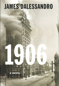 With no release date pinned on the film at the time (though it's since been slated for sometime in 2009), I figured I would check out the book on which the movie is to be based, James Dalessandro's 1906. It was a quick read - I was able to get through the whole thing on one cross-country flight. And, well. If anyone can fix it, I trust Brad Bird can.
The novel suffers from some problems that are unrelated to the geology of the characters' situation. For one, the main character/narrator is a definite Mary Sue: she knows everyone who's anyone in San Francisco, is involved investigating the mayor (even though she's only media), gets to be Caruso's personal tour guide, owns Jack London's old typewriter, and so on, all at the age of 23. Her cop/engineer/geologist-with-a-degree-from-Stanford boyfriend isn't really any better. There are also some problems with the first person perspective, since there are scenes described in vivid detail that there's no way the protagonist would have seen (I'm talking, scene on a train coming from Kansas, let alone scene in the bad guys' secret lair). The entire story is laced with very heavy-handed foreshadowing, to the point where I was thinking, "Alright already, just get to the stinkin' earthquake!" Sure, when you pick up a book or go to see a movie called 1906 with a picture of the burning Call Building as the cover/promotional artwork, you know the earthquake is going to be a major plot point, but I think there are ways such a story could be written so that the reader/viewer, when immersed in the world being presented, would still not see it coming at the precise time that it does. The unexpectedness of earthquakes is a large part of the terror in them, and Dalessandro completely does away with that aspect. Furthermore, none of the main characters behave like normal human beings when the earthquake finally does strike. It comes at a point where there is already conflict going on, and when the shaking ends, the conflict picks up exactly where it left off, as if nothing had happened. One would think that at least a couple of people in the situation would have been utterly freaked out enough by the city shaking down around them to forget what they'd been doing before, or at least lose their place, but nobody in the scene seems to even bat an eye. Maybe they read all the foreshadowing from earlier in the book.
But for these faults (har har), 1906 has a problem that makes it quite singular among disaster movies - it has too much science. You heard right. Dalessandro clearly researched the cultural climate of turn of the 20th century San Francisco - his setting is detailed and colorful and lines up with all the history books I've read about this event so far. And he clearly did some research on the science of earthquakes - there's even a scene where two picnickers on San Andreas Lake notices an alarming rate of preseismic slip along the fault. The problem is that Dalessandro didn't cross reference the two - that is, he didn't check to see how much of that science was known in 1906. Thus, you get characters who are part of the general nonscientific public talking openly about the San Andreas Fault by name, even though it wasn't named until Andrew Lawson's 1908 report on the 1906 event. And the scientifically-inclined characters describe the fault as a boundary between the Pacific and North American plates, a good sixty years before the theory of plate tectonics was presented. Not to mention that scene with the picnic at the fault - the reason the picnic is there is one of the people on it is a seismologist who is deliberately measuring slip on the fault, monitoring it closely due to its threat to the city in the days before the quake. There's nothing scientifically incorrect here. It's just all displaced in time by a matter of years or decades - a huge oversight indeed.
The character stuff, the reactions, and the foreshadowing are all things that I'm sure Brad Bird can fix, since he's apparently in the process of rewriting an earlier version of the script. His other movies are much more subtle in their foreshadowing, and the characters are all more realistic, multifaceted, flawed people (or robots, or rats). I just really hope it occurs to the movie team to check their science and update the script - or perhaps backdate it, as the case may be.
I still plan on seeing 1906 when it comes out. I'm sure it'll look awesome, since Pixar is, it has been recently announced, involved. The murder mystery/tale of scandal of the book is still intriguing, even with the all-too-perfect characters and all-too-obvious earthquake. If worse comes to worse, 1906 will be next in a long line of disaster movies that are so bad that they're funny, but I doubt that, since it is a Brad Bird movie. I'm really hoping I'll be pleasantly surprised, and will be able to enjoy the film in earnest, without having to snark at anachronism.
1906 on IMDB
You know, it would be fun if a bunch of geobloggers went to see this together. Yeah.
Friday, February 22, 2008
What about 22 years before 1857?
Plenty of people are curious about Parkfield. The 6.0 in 2004 simply leaves the question of when the next one will be, how it will relate to the timing of all the others. It's still an excellent place to look at high-magnitude repeating earthquakes, and probably still one of the best places to poke around for some hints toward the holy grail of earthquake prediction.
I think that stuff is interesting, and that these are good questions, but what really makes me go hmmm about Parkfield is what happened there before 1857. All of the lists that I've ever seen of major events there with the 1857 Fort Tejon earthquake, and that average recurrence interval of 22 years is calculated from there on out. But what about beforehand? Has anybody looked into this?
The SAFOD station is about getting current earthquake information from Parkfield, but has anyone done any paleoseismological digging at the site? That would be something I'd like to see. I don't know how well a 22-year recurrence interval would show up in cross section, since that doesn't give much time for new material to accumulate on the old break, but it would answer whether or not the same pattern was going on before 1857.
I've heard a theory that the whole chain of Parkfield events is still part of the Fort Tejon aftershock sequence. That's a tantalizing thought that would accommodate the increasingly longer time between the events. If paleoseismology showed that Parkfield was quiet before 1857, it could add credence to this theory - if they're not aftershocks, something about that quake changed the conditions to make them ripe for repeated earthquakes. But if not aftershocks, that brings up the question of what specific change initiated the sequence.
But if these regular 6-pointers were just as regular before 1857, what made them tick? Surely Parkfield's location between the locked and creeping sections of the fault have something to do with it, but how so? And why did 1857's quake get so much bigger? How many 6s do we get before the next Fort Tejon?
Once I'm done with my music thesis, this is a subject about which I would like to read more. I'm hoping I can find things addressing Parkfield's past when so much attention is given to its future (if any of you know of any good ones, please let me know!), but if there isn't much out there, that's a study that really ought to be done.
I think that stuff is interesting, and that these are good questions, but what really makes me go hmmm about Parkfield is what happened there before 1857. All of the lists that I've ever seen of major events there with the 1857 Fort Tejon earthquake, and that average recurrence interval of 22 years is calculated from there on out. But what about beforehand? Has anybody looked into this?
The SAFOD station is about getting current earthquake information from Parkfield, but has anyone done any paleoseismological digging at the site? That would be something I'd like to see. I don't know how well a 22-year recurrence interval would show up in cross section, since that doesn't give much time for new material to accumulate on the old break, but it would answer whether or not the same pattern was going on before 1857.
I've heard a theory that the whole chain of Parkfield events is still part of the Fort Tejon aftershock sequence. That's a tantalizing thought that would accommodate the increasingly longer time between the events. If paleoseismology showed that Parkfield was quiet before 1857, it could add credence to this theory - if they're not aftershocks, something about that quake changed the conditions to make them ripe for repeated earthquakes. But if not aftershocks, that brings up the question of what specific change initiated the sequence.
But if these regular 6-pointers were just as regular before 1857, what made them tick? Surely Parkfield's location between the locked and creeping sections of the fault have something to do with it, but how so? And why did 1857's quake get so much bigger? How many 6s do we get before the next Fort Tejon?
Once I'm done with my music thesis, this is a subject about which I would like to read more. I'm hoping I can find things addressing Parkfield's past when so much attention is given to its future (if any of you know of any good ones, please let me know!), but if there isn't much out there, that's a study that really ought to be done.
Tuesday, January 22, 2008
The Nevada Beachfront
When I told my friends on the East Coast that I was moving out to California for grad school, many of them responded with comments like, "Please move back east before California falls into the ocean," or, "Be sure to buy a life vest once you're out there!" When I explained in turn that there was no such danger, illustrated with highly-technical sliding of hands past each other to explain the term "strike slip," most of those friends then told me that I was taking them way too seriously on their comments. One, however, still told me not to jump on the San Andreas Fault, just in case.
The fact that this came up in casual conversation with so many people, even on the East Coast, is only a small sign of how pervasive this misconception is. It's become a part of pop culture even more than it's something people actually worry about - well, I certainly hope it's more pop culture than genuine belief, but that would be a hard thing to gauge, and my circle of nerdy friends is probably not the best place to calculate such things. A quick Google search for "California fall into ocean" reveals all too many sites, some of which are those user-asks-question-another-user-answers database sorts of things, which assert that a big splashdown is imminent (this makes one wonder about the credibility of the other information on those question sites). And friend of mine did tell me recently that one of his relatives moved out of California after Northridge and bought a map with the supposed new West Coastline of the United States. One also has to wonder if that map was drawn as a joke, or if the mapmaker is hoping to use those funds from the maps to move away from the supposed sinking slab.
In some ways, the concept of the entirety of California going down doesn't seem too far fetched. This is, after all, a state that routinely has hundreds of square miles catch on fire, where even a moderate amount of rain sends people out sandbagging to curb any neighborhood-demolishing debris flows, where even not-The-Big-One can pancake high rises every decade or so. Not to mention those extremely-poorly-placed beach clifftop houses that do tend to surf the mass wasting events and wipe out in the water. It doesn't seem strange at all that an active imagination used to seeing such stories on the news might extrapolate to an even larger-scale disaster. No matter how much that thought may worry the imaginer, it only becomes truly troublesome when the actual science that disproves the myth gets ignored.
The California falling into the ocean myth actually predates much of the science that disproves it. Though I haven't been able to find any specific date or single source for the origin of this misconception, I have seen references to it in relation to the 1906 San Francisco quake. Following that temblor, all sorts of exaggerated "news" stories wired across the country, including one that the strong shaking had brought the ground under San Francisco down along with the city's buildings; this story quickly expanded to encompass all of California going under. When the San Andreas Fault was eventually blamed for the temblor and mapped out as extending through most of the state, the potential for more earthquakes and the clear line of breakage could have only fed the thought among the non-scientifically-inclined.
(This leads to a sub-misconception. Every version of the story I've seen cites the San Andreas as the line on which the break will occur, but many seem, well, shaky on where the Fault actually is. Some put it as the geographical line that separates California from Nevada. A great many other retellings of the story say that Los Angeles in particular will be swimming with the fishes, with no particular mention of San Francisco, San Diego, or especially not San Bernardino going along with it.)
The best way to fend this one off is, I think, better geology classes earlier on in school. None of this waiting until 12th grade to take a senior “slacker class” business – that’s more than enough time for the conspiracy theorists to get to someone. I don’t think any basic part of this misconception is too complicated to explain to someone in, say, middle school, if not even earlier.
But for all I hope people stop actually believing that California really is going to break off at the San Andreas Fault during a major earthquake and fall into the ocean, I would be sad if the idea faded away from the silly pop culture side of things. Without this myth, there wouldn’t have been those gloriously terrible sequences at the climax of the 1978 Superman movie, in which Lex Luthor implodes the Carrizo Plain section of the fault (highlighting another Faults Don’t Work That Way myth), then Superman flies inside the magma-ridden(!) crevasse to fix it, prompting the exact same footage of the collapse to be shown in reverse. Nor could that popular “End of the World” flash cartoon (NSFW for four-letter words) have gone quite as far with the silliness as it did. And this story has also prompted its fair share of songs, from Tool’s angry-good-riddance "Aenima" (also language NSFW), to Cass Elliott’s happy-good-riddance "California Earthquake", and the more obscure LA-based Little Girls’ perfect parody on SoCal surf tune style "Earthquake Song". Once people can recognize misconceptions as nothing more than that, why not have fun with them?
The fact that this came up in casual conversation with so many people, even on the East Coast, is only a small sign of how pervasive this misconception is. It's become a part of pop culture even more than it's something people actually worry about - well, I certainly hope it's more pop culture than genuine belief, but that would be a hard thing to gauge, and my circle of nerdy friends is probably not the best place to calculate such things. A quick Google search for "California fall into ocean" reveals all too many sites, some of which are those user-asks-question-another-user-answers database sorts of things, which assert that a big splashdown is imminent (this makes one wonder about the credibility of the other information on those question sites). And friend of mine did tell me recently that one of his relatives moved out of California after Northridge and bought a map with the supposed new West Coastline of the United States. One also has to wonder if that map was drawn as a joke, or if the mapmaker is hoping to use those funds from the maps to move away from the supposed sinking slab.
In some ways, the concept of the entirety of California going down doesn't seem too far fetched. This is, after all, a state that routinely has hundreds of square miles catch on fire, where even a moderate amount of rain sends people out sandbagging to curb any neighborhood-demolishing debris flows, where even not-The-Big-One can pancake high rises every decade or so. Not to mention those extremely-poorly-placed beach clifftop houses that do tend to surf the mass wasting events and wipe out in the water. It doesn't seem strange at all that an active imagination used to seeing such stories on the news might extrapolate to an even larger-scale disaster. No matter how much that thought may worry the imaginer, it only becomes truly troublesome when the actual science that disproves the myth gets ignored.
The California falling into the ocean myth actually predates much of the science that disproves it. Though I haven't been able to find any specific date or single source for the origin of this misconception, I have seen references to it in relation to the 1906 San Francisco quake. Following that temblor, all sorts of exaggerated "news" stories wired across the country, including one that the strong shaking had brought the ground under San Francisco down along with the city's buildings; this story quickly expanded to encompass all of California going under. When the San Andreas Fault was eventually blamed for the temblor and mapped out as extending through most of the state, the potential for more earthquakes and the clear line of breakage could have only fed the thought among the non-scientifically-inclined.
(This leads to a sub-misconception. Every version of the story I've seen cites the San Andreas as the line on which the break will occur, but many seem, well, shaky on where the Fault actually is. Some put it as the geographical line that separates California from Nevada. A great many other retellings of the story say that Los Angeles in particular will be swimming with the fishes, with no particular mention of San Francisco, San Diego, or especially not San Bernardino going along with it.)
The best way to fend this one off is, I think, better geology classes earlier on in school. None of this waiting until 12th grade to take a senior “slacker class” business – that’s more than enough time for the conspiracy theorists to get to someone. I don’t think any basic part of this misconception is too complicated to explain to someone in, say, middle school, if not even earlier.
But for all I hope people stop actually believing that California really is going to break off at the San Andreas Fault during a major earthquake and fall into the ocean, I would be sad if the idea faded away from the silly pop culture side of things. Without this myth, there wouldn’t have been those gloriously terrible sequences at the climax of the 1978 Superman movie, in which Lex Luthor implodes the Carrizo Plain section of the fault (highlighting another Faults Don’t Work That Way myth), then Superman flies inside the magma-ridden(!) crevasse to fix it, prompting the exact same footage of the collapse to be shown in reverse. Nor could that popular “End of the World” flash cartoon (NSFW for four-letter words) have gone quite as far with the silliness as it did. And this story has also prompted its fair share of songs, from Tool’s angry-good-riddance "Aenima" (also language NSFW), to Cass Elliott’s happy-good-riddance "California Earthquake", and the more obscure LA-based Little Girls’ perfect parody on SoCal surf tune style "Earthquake Song". Once people can recognize misconceptions as nothing more than that, why not have fun with them?
Subscribe to:
Posts (Atom)