Hello, world! I realize I've failed at the day-to-day writeup of AGU that I promised back in December (eep), but what better way to come back from an unannounced work-induced hiatus than to describe the work I've been doing, hm?
I don't think I've blogged much about the research I do. I know I post about about interesting places I visit, visible and tangible fault features, and outreach, but my actual research doesn't have a field component yet at all. I do work in earthquake dynamics - the physics of how faults rupture. My method so far has been numerical modeling, specifically with both 2d and 3d finite element codes. This method divides both sides of the fault into a grid of elements of a designated size, then applies equations of motion, stress transfer, and wave propagation to each element over each timestep, then sums up the result. Each model represents a single earthquake on a fault; aside from a forced nucleation point, the magnitude and intensity of the quake are determined by the model parameters. There are many existing codes that do this, and I've been working with two of the newer ones. I've also very recently started doing some multi-cycle quasi-dynamic models. These take a fault system and put it through multiple earthquake cycles, including interseismic application of tectonic stresses. What makes them quasi-dynamic is the ruptures work by way of stress state, and don't include dynamic wave propagation.
There are a lot of fault parameters you can tweak in dynamic models, and my work focuses on the effects of fault geometry on rupture behavior and ground motion. Models investigating other parameters might use a fault that's a straight line, but straight lines almost never happen in nature. Faults have branches, bends, discontinuities, and stepovers, and they've proven to be important factors in determining where earthquake rupture stops. There's one field study of mapped surface ruptures (Wesnousky, 2008) that shows that a significant number of surface ruptures die out near a geometrical discontinuity in the mapped fault trace. On the other hand, events like the 1992 Landers earthquake or the 2002 Denali earthquake show that rupture can traverse some considerable discontinuities between faults. Understanding how rupture behaves when it encounters a geometrical discontinuity is therefore very important in determining the hazard associated with individual faults or fault systems.
I already have one fault geometry paper (which also happens to be the first chapter of my Master's thesis) in review. It's a parameter study of whether or not rupture will propagate through a bend in a fault of a given length, with a given connecting angle. Unsurprisingly, steeper angles and longer bends are more likely to halt a rupture, but exactly how steep or long varies depending on whether the step is extensional or compressional (that is, whether the bent segment is pulled apart by the fault's direction of slip, or whether it's crunched together), on the overall size of the fault system, and on the orientation of the stress field acting on the fault. That third criterion is particularly important - in some orientation, dynamic effects control the rupture far more than static ones, but in others, static effects can overcome dynamic ones. I still haven't heard from any reviewers on this paper, but I'm sure I'll post here excitedly when it goes into press.
I'm working on a second paper now, determining how fault geometry affects the intensity and distribution of peak ground motion in an earthquake. In this case, I'm using fault systems that consist of two segments with no linking segment, meaning that rupture has to re-nucleate on the second segment as opposed to just traversing an unfavorable part. I'm looking at both compressional and extensional systems here, with a varied distance between the fault segments, a variety of stress drops, a variety of rupture velocities, and a variety of different rock types. So far, I'm finding that every single one of those parameters affects the pattern and intensity of motion. The talk I gave at AGU (which I will write about, really!) was about preliminary results of this work, and I'll be giving a talk at the Seismological Society of America meeting in Portland in April about the specifics of the material contrast cases.
So that's my research - as I transition into working on a PhD, I'll start investigating more complex geometries and looking at real fault systems, as opposed to hypothetical ones. All that while still taking a bunch of classes to catch up on my background!
Showing posts with label faults. Show all posts
Showing posts with label faults. Show all posts
Friday, March 26, 2010

Sunday, May 17, 2009
A day of kinematic GPS
I really don't mean to be neglecting my blog (or neglecting commenting on your blogs) as much as I have been lately. It's mostly that, after the classes and the rehearsals and the homework and the grading, I put aside the papers and think only of sleep, rather than of spending more time at a screen writing things. I'm accumulating a rather lengthy To-Blog list, which, following Maria's lead> I think I'll have to make a summer break resolution (since New Year's is way too far off) to actually write up.
Anyway, though much of my time this quarter has been spent at a desk, the seminar I'm taking on tectonic geomorphology and quaternary field methods has served well to get me out and about. Many of our "trips" have been into the hills behind campus, mostly for funding reasons, but we have had a few larger outings. The most intensive one so far was when we went to Grass Valley in the San Bernardino Mountains to make a digital elevation map using kinematic GPS. (There was also a USGS/Caltech team out there using LiDAR to image some precariously balanced rocks, but we did not get to actively participate in this part of the work; we were mere observers.)
Grass Valley is located in the San Bernardino Mountains, not far from Lake Arrowhead. It falls into the region of highest possible threat of major earthquake ground motion in the state, due to its proximity to several major faults. The San Andreas Fault is 11 kilometers away, with several well-constrained paleoseismic sites within 20 km. The San Jacinto Fault is only a kilometer or two further away than the San Andreas; the north frontal thrust of the San Bernardino Mountains is about the same distance away to the north. The Cleghorn Fault runs directly through Grass Valley, though its activity isn't as well constrained; there's no current microseismicity, and no evidence of Holocene rupture.
The precariously balanced rock team was clearly there to try and constrain whether or not the worst case scenario of shaking according to the state hazard report had actually ever happened since those rocks became precarious to begin with. The focus of the class exercise, however, was more on a catchment containing a small system of drainages in the process of being captured by the Mojave River. Our goal was to use kinematic GPS to get a good picture of the area, which could then be used to better situate the precariously balanced rocks in the middle of the site.
Kinematic GPS is a method of relative measurement. Actual latitude/longitude figures don't come into play. All measurements are taken relative to a base station that gets set up somewhere central in the site, for the express purpose of kinematic GPS measurement. People then carry portable GPS antennae, either attached to a backpack or on a long pole, all over the area surrounding the base station. The goal is to go back and forth over all of the bumps and dips in topography - even though that does, of course, make for harder hiking at times - to make sure they show up in the DEM. The data has to be corrected for height of the person carrying the antenna (I was not, shockingly, the shortest one!) and for roughness of gait, but the corrections that need to be made can be gauged by having all of the antenna-carryers walk the same path before going their separate ways.
We spent a full afternoon tromping around the catchment, and the four of us managed to cross paths only a couple of times, hopefully implying that we didn't all cover the same ground. In my run-in with one of the professors, I was detailed to walk around the far edge of the site that hadn't yet been covered. I did so, but then I proceeded to overshoot the other edge of the site and get quite confused. I continued to walk through all of the (mostly-dry) drainages I could find for a while, but I started to get worried when I wasn't catching sight of the base station or the precariously balanced rocks. I definitely realized the irony of not having a clue where I was, despite having a GPS antenna strapped to my back, but dark humor wasn't going to get me out of the situation on its own. I did manage to work my way back to the road, then proceeded to go the wrong way on it for about half a mile before I noticed that I was wrong. It turns out I'd found the road only about 200 yards shy of the turnoff that lead straight to the base station. Ah well!
I haven't seen our DEM yet, though I'm told we covered a lot of ground, and I'm told that there was one antenna that went quite a bit further away than all the others did. One of the people in the class is doing all the processing as his final project for said class, so I may ask him if I can show off the results of our day in the field.
Anyway, though much of my time this quarter has been spent at a desk, the seminar I'm taking on tectonic geomorphology and quaternary field methods has served well to get me out and about. Many of our "trips" have been into the hills behind campus, mostly for funding reasons, but we have had a few larger outings. The most intensive one so far was when we went to Grass Valley in the San Bernardino Mountains to make a digital elevation map using kinematic GPS. (There was also a USGS/Caltech team out there using LiDAR to image some precariously balanced rocks, but we did not get to actively participate in this part of the work; we were mere observers.)
Grass Valley is located in the San Bernardino Mountains, not far from Lake Arrowhead. It falls into the region of highest possible threat of major earthquake ground motion in the state, due to its proximity to several major faults. The San Andreas Fault is 11 kilometers away, with several well-constrained paleoseismic sites within 20 km. The San Jacinto Fault is only a kilometer or two further away than the San Andreas; the north frontal thrust of the San Bernardino Mountains is about the same distance away to the north. The Cleghorn Fault runs directly through Grass Valley, though its activity isn't as well constrained; there's no current microseismicity, and no evidence of Holocene rupture.
The precariously balanced rock team was clearly there to try and constrain whether or not the worst case scenario of shaking according to the state hazard report had actually ever happened since those rocks became precarious to begin with. The focus of the class exercise, however, was more on a catchment containing a small system of drainages in the process of being captured by the Mojave River. Our goal was to use kinematic GPS to get a good picture of the area, which could then be used to better situate the precariously balanced rocks in the middle of the site.
Kinematic GPS is a method of relative measurement. Actual latitude/longitude figures don't come into play. All measurements are taken relative to a base station that gets set up somewhere central in the site, for the express purpose of kinematic GPS measurement. People then carry portable GPS antennae, either attached to a backpack or on a long pole, all over the area surrounding the base station. The goal is to go back and forth over all of the bumps and dips in topography - even though that does, of course, make for harder hiking at times - to make sure they show up in the DEM. The data has to be corrected for height of the person carrying the antenna (I was not, shockingly, the shortest one!) and for roughness of gait, but the corrections that need to be made can be gauged by having all of the antenna-carryers walk the same path before going their separate ways.
We spent a full afternoon tromping around the catchment, and the four of us managed to cross paths only a couple of times, hopefully implying that we didn't all cover the same ground. In my run-in with one of the professors, I was detailed to walk around the far edge of the site that hadn't yet been covered. I did so, but then I proceeded to overshoot the other edge of the site and get quite confused. I continued to walk through all of the (mostly-dry) drainages I could find for a while, but I started to get worried when I wasn't catching sight of the base station or the precariously balanced rocks. I definitely realized the irony of not having a clue where I was, despite having a GPS antenna strapped to my back, but dark humor wasn't going to get me out of the situation on its own. I did manage to work my way back to the road, then proceeded to go the wrong way on it for about half a mile before I noticed that I was wrong. It turns out I'd found the road only about 200 yards shy of the turnoff that lead straight to the base station. Ah well!
I haven't seen our DEM yet, though I'm told we covered a lot of ground, and I'm told that there was one antenna that went quite a bit further away than all the others did. One of the people in the class is doing all the processing as his final project for said class, so I may ask him if I can show off the results of our day in the field.
Friday, April 17, 2009
Airliner Chronicles: LAX to SFO
I flew Virgin America from LAX to SFO today. I mention the airline specifically because I know for a fact that their particular air routes make for an awesome view out the window. (Also, their airplanes have wireless internet on them. Seriously. How cool is that?) But yes, if you are someone who likes landforms and faults and have to make this flight on that airline, I urge you to make the strongest effort possible to get a window seat on the right side of the plane. The view kept me far more entertained than the novelty of airborne WiFi ever could.
The first few minutes of the flight clung to the coast, but we swung back inland and caught up with the San Andreas Fault around the Big Bend. From there, we flew over...
The Carrizo Plain:
Cholame Valley (Parkfield's in there somewhere - just too small to see from that high up!):
Pinnacles National Monument (the exposed rock in the upper middle of the picture, with the city of Soledad in the foreground):
Loma Prieta (though I'm not entirely sure which of these peaks it is):
San Andreas in San Mateo (or possibly northern Santa Cruz) County (I think this is my favorite of the pictures):
I was definitely pretty giddy with excitement over the whole view by the time we landed at SFO. I suspect the way back to LAX will be just as awesome, if not more so, since I'll be flying in the middle of the day rather than at 6 PM. I managed to snag a window seat on the left side of the plane for that flight.
The first few minutes of the flight clung to the coast, but we swung back inland and caught up with the San Andreas Fault around the Big Bend. From there, we flew over...
The Carrizo Plain:

Cholame Valley (Parkfield's in there somewhere - just too small to see from that high up!):

Pinnacles National Monument (the exposed rock in the upper middle of the picture, with the city of Soledad in the foreground):

Loma Prieta (though I'm not entirely sure which of these peaks it is):

San Andreas in San Mateo (or possibly northern Santa Cruz) County (I think this is my favorite of the pictures):

I was definitely pretty giddy with excitement over the whole view by the time we landed at SFO. I suspect the way back to LAX will be just as awesome, if not more so, since I'll be flying in the middle of the day rather than at 6 PM. I managed to snag a window seat on the left side of the plane for that flight.
Wednesday, February 25, 2009
...and then two more.
I was tempted, in light of specific sentences said by a particular politician yesterday, to forgo my planned Accretionary Wedge post and instead write about how every geologist, at some point in his or her life, should engage in a little volcano monitoring. I totally stand by my statement (and will be taking a class next quarter that absolutely involves volcano monitoring), but I also recall that we're collectively trying to come with 100 things, and there is certainly enough room in the budget of geological curiosity/exploration for me to write about those things in addition to snarking about things that other members of the geoblogosphere have already addressed so eloquently.
And now, the post I was planning to write before this madness went down.
The original 100 Places Meme lists the San Andreas Fault as a Must-See. I absolutely agree with this, but as I was marking the text on the list in bold, I got to thinking about how those three words mean a whole slew of very different places, spread out over hundreds of miles. The ultimate San Andreas experience is, of course, to drive the whole thing (or, well, the parts that are on land). I can't check off the full 800 miles yet, but I've been from the southern end of the Fault at the Salton Sea up through Point Reyes, mostly on roads that cling pretty close to the surface trace. I definitely recommend this drive as a means to check off the San Andreas on the original meme, but I also feel like there are several specific must-see sites along its trace (and within its system of associate faults) that deserve space on the expanded list.
The first place that came to mind, without me even having to really think about it, is Carrizo Plain National Monument, in rural San Luis Obispo County. The quintessential image of the San Andreas, the one that pops up in all sorts of textbooks and popular science books about earthquakes, the first photo that turns up when one does a google image search for the San Andreas, is from the Carrizo. It's an aerial photo of the Elkhorn Scarp, also known as the Dragon's Backbone, a 17-mile-long pressure ridge that, from above, looks like a gaping chasm into the depths of the Earth. (The original Superman movie actually does use the scarp as Supes' entry point into the fault...) It is a spectacular photo, but the view from the ground is equally breathtaking, and has the added bonus of debunking the faults-as-gaping-chasms myth.
The Carrizo Plain is one of the best places to see a wide variety of features associated with continental strike-slip faults. In addition to the outstanding pressure ridge, there is the famous Wallace Creek. This streambed crosses the San Andreas, but not without getting pulled around a bit first. Wallace Creek takes a sharp right angle turn as it meets the Fault, then parallels it for some 130 feet before heading back on its course. This shows the displacement power that the San Andreas has, and is all the more staggering when taking into account that some people think a good percentage of that displacement came from the 1857 earthquake alone. There are plenty of other offset streambeds that are less dramatic, as well as some channels that have been "beheaded" by the fault. The Carrizo also boasts more typical scarps, some spots of more trenchlike fault expression, stepovers with traceable surface expression, and a few (mostly dry) sag ponds.

If faults aren't really your thing, the Carrizo Plain is still worth a visit. The northernmost part of the Plain contains Soda Lake, a huge alkaline lake out of which many spectacular mineral samples (some of which are in the Visitor's Center, which is not open all the time) have been extracted from not very deep. The Carrizo is also thought to be an example of what the native Californian landscape might have looked like before the Europeans did anything to it - fields dominated by wildflowers and scrubby plants. For this reason, late March and early April are the best time to visit, since the wildflowers are out in full force, and the entire Plain is painted in shades of green, yellow, orange, and blue. (Don't go in the middle of the summer, though, unless you like triple digit temperatures.)
The next place I want to add to the list doesn't strictly feature the San Andreas; the town of Hollister's bisector is the Calaveras Fault, though the Calaveras branches off from the San Andreas just south of the town. The seat of San Benito County may lack scenes of breathtaking beauty that could make even a non-geologist drool, but it's also one of the best places to see the bizarre California-centric phenomenon known as aseismic creep. Creep is a phenomenon in which a fault moves slowly and steadily at around the tectonic loading rate, constantly releasing stress in a way that does not radiate seismic waves and generally prohibits enough buildup to cause a large quake (though some creeping faults may have asperities within the creeping zone that still accumulate stress and rupture seismically, even though creep continues around that zone). The main place (if not the only - I haven't heard of it elsewhere) this has been observed is in California, specifically on the Hayward, Calaveras, and Rogers Creek Faults in the Bay Area, the San Andreas between Parkfield and San Juan Bautista, and the Superstition Hills Fault near the Mexican border.
Creep can be measured with all sorts of complex instrumentation, but its easiest for the layperson to see when some sort of manmade structure gets put on the fault, and proceeds to get bent and deflected and cracked. The cities of Santa Rosa, Berkeley, Hayward, Fremont, and others all have the trademark offset curbs of a creeping fault, but I personally think that Hollister is the best city to look for offset because it looks like they've put less effort (or money) into patching up the distortion. Some sidewalks are bent several feet out of line, many streets are crossed by sets of en echelon cracks, and some houses and garages have obvious bulges in the walls and cracks in the foundation.

So Hollister is a good place to see creep as a phenomenon in and of itself, but it's also a clear exhibition of the interaction between the Earth itself and its inhabitants, of how people keep living in some places in spite of the geology. I suspect the fault was not known to be there when Hollister was first founded, which could explain some of the spectacularly bad locations of houses, but towns like this can be an example of how the hazards of the landscape should be taken into account when planning future development.
Not to mention that such intersections of humanity and seismicity make it clear that Fault Monitoring is also pretty darn important...
And now, the post I was planning to write before this madness went down.
The original 100 Places Meme lists the San Andreas Fault as a Must-See. I absolutely agree with this, but as I was marking the text on the list in bold, I got to thinking about how those three words mean a whole slew of very different places, spread out over hundreds of miles. The ultimate San Andreas experience is, of course, to drive the whole thing (or, well, the parts that are on land). I can't check off the full 800 miles yet, but I've been from the southern end of the Fault at the Salton Sea up through Point Reyes, mostly on roads that cling pretty close to the surface trace. I definitely recommend this drive as a means to check off the San Andreas on the original meme, but I also feel like there are several specific must-see sites along its trace (and within its system of associate faults) that deserve space on the expanded list.
The first place that came to mind, without me even having to really think about it, is Carrizo Plain National Monument, in rural San Luis Obispo County. The quintessential image of the San Andreas, the one that pops up in all sorts of textbooks and popular science books about earthquakes, the first photo that turns up when one does a google image search for the San Andreas, is from the Carrizo. It's an aerial photo of the Elkhorn Scarp, also known as the Dragon's Backbone, a 17-mile-long pressure ridge that, from above, looks like a gaping chasm into the depths of the Earth. (The original Superman movie actually does use the scarp as Supes' entry point into the fault...) It is a spectacular photo, but the view from the ground is equally breathtaking, and has the added bonus of debunking the faults-as-gaping-chasms myth.
The Carrizo Plain is one of the best places to see a wide variety of features associated with continental strike-slip faults. In addition to the outstanding pressure ridge, there is the famous Wallace Creek. This streambed crosses the San Andreas, but not without getting pulled around a bit first. Wallace Creek takes a sharp right angle turn as it meets the Fault, then parallels it for some 130 feet before heading back on its course. This shows the displacement power that the San Andreas has, and is all the more staggering when taking into account that some people think a good percentage of that displacement came from the 1857 earthquake alone. There are plenty of other offset streambeds that are less dramatic, as well as some channels that have been "beheaded" by the fault. The Carrizo also boasts more typical scarps, some spots of more trenchlike fault expression, stepovers with traceable surface expression, and a few (mostly dry) sag ponds.

If faults aren't really your thing, the Carrizo Plain is still worth a visit. The northernmost part of the Plain contains Soda Lake, a huge alkaline lake out of which many spectacular mineral samples (some of which are in the Visitor's Center, which is not open all the time) have been extracted from not very deep. The Carrizo is also thought to be an example of what the native Californian landscape might have looked like before the Europeans did anything to it - fields dominated by wildflowers and scrubby plants. For this reason, late March and early April are the best time to visit, since the wildflowers are out in full force, and the entire Plain is painted in shades of green, yellow, orange, and blue. (Don't go in the middle of the summer, though, unless you like triple digit temperatures.)
The next place I want to add to the list doesn't strictly feature the San Andreas; the town of Hollister's bisector is the Calaveras Fault, though the Calaveras branches off from the San Andreas just south of the town. The seat of San Benito County may lack scenes of breathtaking beauty that could make even a non-geologist drool, but it's also one of the best places to see the bizarre California-centric phenomenon known as aseismic creep. Creep is a phenomenon in which a fault moves slowly and steadily at around the tectonic loading rate, constantly releasing stress in a way that does not radiate seismic waves and generally prohibits enough buildup to cause a large quake (though some creeping faults may have asperities within the creeping zone that still accumulate stress and rupture seismically, even though creep continues around that zone). The main place (if not the only - I haven't heard of it elsewhere) this has been observed is in California, specifically on the Hayward, Calaveras, and Rogers Creek Faults in the Bay Area, the San Andreas between Parkfield and San Juan Bautista, and the Superstition Hills Fault near the Mexican border.
Creep can be measured with all sorts of complex instrumentation, but its easiest for the layperson to see when some sort of manmade structure gets put on the fault, and proceeds to get bent and deflected and cracked. The cities of Santa Rosa, Berkeley, Hayward, Fremont, and others all have the trademark offset curbs of a creeping fault, but I personally think that Hollister is the best city to look for offset because it looks like they've put less effort (or money) into patching up the distortion. Some sidewalks are bent several feet out of line, many streets are crossed by sets of en echelon cracks, and some houses and garages have obvious bulges in the walls and cracks in the foundation.

So Hollister is a good place to see creep as a phenomenon in and of itself, but it's also a clear exhibition of the interaction between the Earth itself and its inhabitants, of how people keep living in some places in spite of the geology. I suspect the fault was not known to be there when Hollister was first founded, which could explain some of the spectacularly bad locations of houses, but towns like this can be an example of how the hazards of the landscape should be taken into account when planning future development.
Not to mention that such intersections of humanity and seismicity make it clear that Fault Monitoring is also pretty darn important...
Thursday, December 25, 2008
AGU 2008
...or, How I Psyched Myself Out, 1906-Style
I have finally recovered from the conference-excitement-lack-of-sleep, the redeye flight, the jetlag, and the frantic preparations for a certain winter holiday. Now it is time for the belated Conference Post! I'm going to do AGU all in one go, since my attempt to day-by-day blog SCEC failed worse than an unreenforced masonry building in a 7.8 quake. One of my resolutions for 2009 is to be better about posting more things in a more timely manner - and about commenting more on all of your posts as well!
Monday, 15 December
My flight from Ontario (California) left at a perfectly sane 9 AM, but I was kind of stupid and spent three hours on the 14th playing bluegrass music with friends, then realized that I still had to pack and get everything ready. The end result was that I only got about three hours of sleep, between late bedtime, not sleeping well due to excitement, and having to get up at 6 to catch the airport shuttle. Despite crappy weather, there were no problems getting to Oakland by air, and then by BART to San Francisco proper. My main thought after checking in was food, though, and I was able to meet up with friends from school for this reason. Upon looking at the schedule, we realized that none of the talks that afternoon were all that relevant to our own research, so we decided to take the afternoon and be lazy zombie tourists and go stare at the sea lions at Fisherman's Wharf. The sea lions are awesome. I think that if I lived in San Francisco, I would still go down there to watch the sea lions. By the time we were done there, it was late enough that I could check into the hotel. This was exciting, because hotels.com happened to be having a huge rate sale on a particular historic place the day I was checking rates for AGU. I therefore got to stay at The Palace, established 1875, which managed to not shake down in 1906, even though the fire still gutted it. It was rebuilt in time for a 1908 reopening, and the interior is still very different from modern hotels. It really felt like staying in a different time, particularly since there was no internet in the room and I was thereby cut off from my little white lifeline to the intarwebz/modern world. I was utterly thrilled by this notion of antiquity, even though I think it ended up psyching me out a little.
Tuesday, 16 December
The psyching out started immediately. I'd set my alarm for 7 AM, but I woke up at 5:10, and couldn't fall asleep again until the clock had gone past 5:12 - which was the exact time of the 1906 quake. At least I did fall back asleep, and I was excited enough about going to sessions that waking up at 7 wasn't hard. My first order of business, though, was to help set up the UCR booth in the exhibition hall. My adviser had sent me to SF with a suitcase full of propaganda, a banner, and a string with which to somehow put up said banner. I wasn't quite sure how to set this up, and after much frustration, the kind people at the Rice booth took pity on me and gave me velcro, which worked. After everything was set up, I went to a session on fault zone evolution through the seismic cycle that gave me a bunch of ideas for things to look into/possible directions to go once I've entered into Dissertationland. Sure, I'm still in Thesisville, but the more ideas the better for later! I met up with my adviser and his other student for lunch, and we discussed those ideas, as well as some work on tsunamis I might be helping with this coming winter. On Tuesday afternoon, I went to a session on earthquake faulting, which turned out to be much more about using waves to characterize/outline fault zones than about fault mechanics. This meant I didn't get nearly as many ideas for my own work as I had from the morning session, but it did fill me in on some of the background I don't have, so it was still a very useful thing. I spent the later session on Tuesday browsing the exhibit hall (and picking up all kinds of stuff, and doing such things as finally joining the Seismological Society of America). The evening was filled with having dessert before dinner, then celebrating the birthday of a friend who was also at the conference, and who is abandoning Riverside for Winnipeg. I will assure her here, as in person, that polar bears will not eat her during her fieldwork.
Wednesday, 17 December
I woke up at 4:31 AM. Though it was early, I was initially glad, since I thought the psyching out had only lasted one day. Then I remembered that the Northridge quake was at 4:31 AM, and it was on the 17th of the month (though January rather than December), and I felt like punching my subconscious in the face. At least I was able to get back to sleep this time as well, and to wake up just fine at 7. I spent the first part of the morning at the UCR booth, which managed to attract no visitors whatsoever while I was sitting there. None of the other school booths seemed to have much attention either, probably because they stuck us all in the back, but it was still kind of lame. The second half of the morning was spent in a session on earthquake simulators, which covered different types of code people were developing to run individual quake simulations, as well as longer-term whole-California multi-cycle simulators. One of these talks involved a state-wide simulator and the phrase, "This starts with the Hayward Fault going in 2008." There was nervous laughter. Would it not be a worst-case scenario not just for that fault to go, but for it to go while all of the people who study quakes are in a place that would be hit hard? Yikes! I noticed one Andrew Alden standing behind me during this session, but I didn't want to turn around and mention that I knew him from Teh Intarwebz mid-session. He left before I could catch him and say hi. I managed to miss the first afternoon session (I'd planned on going to one on earthquake strong motion) because it took so long to find a restaurant without a line, then to still wait and eat, then to go drop off/pick up stuff in my room. I did make it back for the 4 PM session on fault simulations, but this also wasn't want I expected - it was mostly lab friction experiments, the highlight of which unrealistically involved melt spewing out of a rotary fault plane.
There was one thing about Wednesday that I'd been eagerly awaiting from the beginning of the conference, if not earlier - namely, the geoblogger meetup at the Thirsty Bear. I'd read about this meetup last year, before I'd started my own blog, before I'd been accepted in to the geophysics program. I wanted to be there and meet you guys, and I'm so glad I got to this year! It was great to meet Kim, Ron, Lee, David, Dave, Jay, and Sciencewoman in person; we talked about all kinds of things, from which people in our respective parts of the field should be known to people outside the field, to where are good places for gigapanning, to what should or shouldn't be put in a blog. Ron posted photographic evidence and more details here.
Thursday, 18 December
I woke up at 5:20 and immediately thought, "Yes, progress!" before going back to sleep. I was pretty much a slacker about attending things on Thursday morning, too. I did at least cruise through the poster hall to look over the tectonophysics posters on understanding strike-slip fault systems, and some of the seismology posters on laboratory fault experiments. The best part about this was a few posters on the Garlock fault, its geometry, and the possible stress conditions that could have led to its formation and current state of motion/slip. We sort of had a little Garlock fanclub going in that corner as we discussed these things, and I came out of that with another set of ideas for Dissertationland. After this, I went to lunch with my friend who's abandoning SoCal for the Great White North, and I kept giving her crap about the souvenir San Francisco thermometer in the chocolate store might be a good reminder of California, but it didn't go low enough for where she was headed. She also admitted she'd rather be eaten by a sea lion than by a polar bear. Thursday afternoon made up for my morning slackerness, though; all of the fault dynamics seismology talks were that afternoon, as well as the strike-slip system tectonophysics talks, and in some cases, I was torn over which talk I wanted to hear more. Not fair, I say, putting the two most relevant sessions to my work at exactly the same time! I ended up running back and forth between these two sessions quite a bit, and I think I made good choices for the specific talks, because both Thesisville and Dissertationland received many new idea-inhabitants. A friend of mine who was a SCEC intern at UCR over the summer had a talk during the latter seismology session - her first ever conference talk - and she did a particularly good job and received good questions. For this resounding success, as well as the success of one of our department's undergrads at her Wednesday poster session and at my impending Friday morning session, we (three students, plus my adviser and a friend of his from a nearby school) went into Chinatown and had dinner at a fantastic restaurant called House of Nanking. My adviser's friend told the waitress to hit us with the kitchen's best shot, and they kept bringing out plate after plate of delicious food. I highly recommend this place, though I don't remember the specific address. I just know it's on Kearny, and on the left, if you're walking from Market. On the walk back after dinner, we got a UCR fault dynamics lab photo at Lotta's Fountain, which is the site of the yearly 1906 anniversary ceremony.
 I'm the short one with the seismogram sweatshirt.
Friday, 19 January
I woke up at what felt like early, but was frustrated and refused to open my eyes for a few seconds. Finally, though, morbid curiosity gave in, and I opened my eyes just in time to see the clock switch from 5:12 to 5:13. Curses! I only got to sleep for another hour after that, because I had to be at the Moscone Center by 7:30 to put up my poster. I was initially worried, since they'd given me a Friday morning session, that most people would have left, but the hall ended up being as packed as it was earlier in the week. I'd put up a sign saying I'd be at the poster from 8 to 10, but so many people came by with good suggestions and input and thoughts and questions that I ended up staying and discussing until 11:15, and the only reason I left then was because I had to check out of the hotel. Almost all of the input was positive (the one negative response was along the lines of, "I don't see what this research is for," rather than "you suck and this is stupid"), and I came out of the session with more specific ideas of what I am going to do immediately next, before writing up this paper, as soon as winter break is over and I'm back in the lab. It also did a lot for my confidence - while I feel like I'm doing good work, and people in my department have said so, I still have a serious nagging confidence issue directly related to my background in music. People saying they wanted to keep in touch on the progress of my work was awesomely encouraging, as was the fact that some of the main people who work on fault geometry issues told me that I had impressive results for just one quarter of grad school so far. The music issue only even came up with one person, and he was pretty much floored when I told him. A couple more conferences like that, and I think I'll have squished the lack-of-confidence issue pretty well. After checking out of the hotel, I had lunch and coffee with a friend who's a geophysics undergrad at Berkeley; he wasn't attending AGU, but he came across the Bay to hang out, which was a lot of fun. We had very nerdy conversations, walked around a lot, and he made a point to show me some buildings that still had very obvious 1906 burn marks. For all I've read about that quake, for all the photos I've seen, seeing the scars in person drives it home all that much more. Once he left, I spent the last part of the afternoon in the poster room, hovering near mine (though I had no more visitors) and skimming others that I hadn't had a chance to check out in the morning. I was actually pretty sad when it came time to finally take the poster down and head out, since I'd enjoyed myself and learned so much in those five crazy busy days. At least I didn't have to leave the City yet, though; I hadn't managed to get a flight to Washington DC (where my family lives) until the 20th, so I had a whole other day, even though I had to relocate to a different hotel in Millbrae.
Saturday, 20 December
I woke up and the clock said 5:12. Even removed from The Palace, it continues! Ahhhh! I was free to not set alarms and be generally leisurely that morning, though, but even without deadlines, I still was on BART back into San Francisco by 10 AM. I spent the entire day just wandering around the City on foot - along the Embarcadero, stopping for lunch at Fisherman's Wharf (and spending more time watching the sea lions, of course), then taking the streetcar back into the financial district and wandering up and down many of the streets. I was trying to find as much 1906 as I could - that is, buildings that had withstood the storm, or those that were proud to proclaim they were among the first ones to be rebuilt. I found quite a few. Some of them, like the Hotel St. Francis or the Flood Building, were ones that I knew specifically to look for, but I came across just as many by accident. They're in there among all the newer buildings, integrated into a city that's beautifully eclectic, speaking loudly of a history from which they recovered but cannot - and should not - escape. They show that San Francisco could take what was thrown at it, and if it could be that strong then - even with the lack of scientific knowledge, and with the bad handling of certain aspects of the recovery effort - it will hopefully be as strong the next time. And there will be a next time, which struck me as sadder than ever after spending a week in San Francisco. I couldn't help but visualize walking down the devastated streets of the historic photos, with the jagged broken brickwork against a dusted-out blue sky, all the while I was glad for being in the solid modern city. Thinking about that, and walking past Lotta's Fountain and the burn-scarred DeYoung building every day on the way to the Moscone Center, made the concept of leaving San Francisco even harder. Some part of me worried - irrationally, I hope - that it might be gone before I could go back. I admit to almost having cried, thinking both about 1906 and about having to leave. But leaving had to happen, and I took BART to the airport, had stupid layover in LAX (worst airport EVER), and red-eyed it over to Washington DC, where I am now.
And so it was a great first AGU. I got so much out of it - from the insight and background into all things earthquake, to specific ideas for my own research, to meeting all kinds of awesome and interesting people, to the realization that I totally want to live in San Francisco some day. I already look forward to next year!
I have finally recovered from the conference-excitement-lack-of-sleep, the redeye flight, the jetlag, and the frantic preparations for a certain winter holiday. Now it is time for the belated Conference Post! I'm going to do AGU all in one go, since my attempt to day-by-day blog SCEC failed worse than an unreenforced masonry building in a 7.8 quake. One of my resolutions for 2009 is to be better about posting more things in a more timely manner - and about commenting more on all of your posts as well!
Monday, 15 December
My flight from Ontario (California) left at a perfectly sane 9 AM, but I was kind of stupid and spent three hours on the 14th playing bluegrass music with friends, then realized that I still had to pack and get everything ready. The end result was that I only got about three hours of sleep, between late bedtime, not sleeping well due to excitement, and having to get up at 6 to catch the airport shuttle. Despite crappy weather, there were no problems getting to Oakland by air, and then by BART to San Francisco proper. My main thought after checking in was food, though, and I was able to meet up with friends from school for this reason. Upon looking at the schedule, we realized that none of the talks that afternoon were all that relevant to our own research, so we decided to take the afternoon and be lazy zombie tourists and go stare at the sea lions at Fisherman's Wharf. The sea lions are awesome. I think that if I lived in San Francisco, I would still go down there to watch the sea lions. By the time we were done there, it was late enough that I could check into the hotel. This was exciting, because hotels.com happened to be having a huge rate sale on a particular historic place the day I was checking rates for AGU. I therefore got to stay at The Palace, established 1875, which managed to not shake down in 1906, even though the fire still gutted it. It was rebuilt in time for a 1908 reopening, and the interior is still very different from modern hotels. It really felt like staying in a different time, particularly since there was no internet in the room and I was thereby cut off from my little white lifeline to the intarwebz/modern world. I was utterly thrilled by this notion of antiquity, even though I think it ended up psyching me out a little.
Tuesday, 16 December
The psyching out started immediately. I'd set my alarm for 7 AM, but I woke up at 5:10, and couldn't fall asleep again until the clock had gone past 5:12 - which was the exact time of the 1906 quake. At least I did fall back asleep, and I was excited enough about going to sessions that waking up at 7 wasn't hard. My first order of business, though, was to help set up the UCR booth in the exhibition hall. My adviser had sent me to SF with a suitcase full of propaganda, a banner, and a string with which to somehow put up said banner. I wasn't quite sure how to set this up, and after much frustration, the kind people at the Rice booth took pity on me and gave me velcro, which worked. After everything was set up, I went to a session on fault zone evolution through the seismic cycle that gave me a bunch of ideas for things to look into/possible directions to go once I've entered into Dissertationland. Sure, I'm still in Thesisville, but the more ideas the better for later! I met up with my adviser and his other student for lunch, and we discussed those ideas, as well as some work on tsunamis I might be helping with this coming winter. On Tuesday afternoon, I went to a session on earthquake faulting, which turned out to be much more about using waves to characterize/outline fault zones than about fault mechanics. This meant I didn't get nearly as many ideas for my own work as I had from the morning session, but it did fill me in on some of the background I don't have, so it was still a very useful thing. I spent the later session on Tuesday browsing the exhibit hall (and picking up all kinds of stuff, and doing such things as finally joining the Seismological Society of America). The evening was filled with having dessert before dinner, then celebrating the birthday of a friend who was also at the conference, and who is abandoning Riverside for Winnipeg. I will assure her here, as in person, that polar bears will not eat her during her fieldwork.
Wednesday, 17 December
I woke up at 4:31 AM. Though it was early, I was initially glad, since I thought the psyching out had only lasted one day. Then I remembered that the Northridge quake was at 4:31 AM, and it was on the 17th of the month (though January rather than December), and I felt like punching my subconscious in the face. At least I was able to get back to sleep this time as well, and to wake up just fine at 7. I spent the first part of the morning at the UCR booth, which managed to attract no visitors whatsoever while I was sitting there. None of the other school booths seemed to have much attention either, probably because they stuck us all in the back, but it was still kind of lame. The second half of the morning was spent in a session on earthquake simulators, which covered different types of code people were developing to run individual quake simulations, as well as longer-term whole-California multi-cycle simulators. One of these talks involved a state-wide simulator and the phrase, "This starts with the Hayward Fault going in 2008." There was nervous laughter. Would it not be a worst-case scenario not just for that fault to go, but for it to go while all of the people who study quakes are in a place that would be hit hard? Yikes! I noticed one Andrew Alden standing behind me during this session, but I didn't want to turn around and mention that I knew him from Teh Intarwebz mid-session. He left before I could catch him and say hi. I managed to miss the first afternoon session (I'd planned on going to one on earthquake strong motion) because it took so long to find a restaurant without a line, then to still wait and eat, then to go drop off/pick up stuff in my room. I did make it back for the 4 PM session on fault simulations, but this also wasn't want I expected - it was mostly lab friction experiments, the highlight of which unrealistically involved melt spewing out of a rotary fault plane.
There was one thing about Wednesday that I'd been eagerly awaiting from the beginning of the conference, if not earlier - namely, the geoblogger meetup at the Thirsty Bear. I'd read about this meetup last year, before I'd started my own blog, before I'd been accepted in to the geophysics program. I wanted to be there and meet you guys, and I'm so glad I got to this year! It was great to meet Kim, Ron, Lee, David, Dave, Jay, and Sciencewoman in person; we talked about all kinds of things, from which people in our respective parts of the field should be known to people outside the field, to where are good places for gigapanning, to what should or shouldn't be put in a blog. Ron posted photographic evidence and more details here.
Thursday, 18 December
I woke up at 5:20 and immediately thought, "Yes, progress!" before going back to sleep. I was pretty much a slacker about attending things on Thursday morning, too. I did at least cruise through the poster hall to look over the tectonophysics posters on understanding strike-slip fault systems, and some of the seismology posters on laboratory fault experiments. The best part about this was a few posters on the Garlock fault, its geometry, and the possible stress conditions that could have led to its formation and current state of motion/slip. We sort of had a little Garlock fanclub going in that corner as we discussed these things, and I came out of that with another set of ideas for Dissertationland. After this, I went to lunch with my friend who's abandoning SoCal for the Great White North, and I kept giving her crap about the souvenir San Francisco thermometer in the chocolate store might be a good reminder of California, but it didn't go low enough for where she was headed. She also admitted she'd rather be eaten by a sea lion than by a polar bear. Thursday afternoon made up for my morning slackerness, though; all of the fault dynamics seismology talks were that afternoon, as well as the strike-slip system tectonophysics talks, and in some cases, I was torn over which talk I wanted to hear more. Not fair, I say, putting the two most relevant sessions to my work at exactly the same time! I ended up running back and forth between these two sessions quite a bit, and I think I made good choices for the specific talks, because both Thesisville and Dissertationland received many new idea-inhabitants. A friend of mine who was a SCEC intern at UCR over the summer had a talk during the latter seismology session - her first ever conference talk - and she did a particularly good job and received good questions. For this resounding success, as well as the success of one of our department's undergrads at her Wednesday poster session and at my impending Friday morning session, we (three students, plus my adviser and a friend of his from a nearby school) went into Chinatown and had dinner at a fantastic restaurant called House of Nanking. My adviser's friend told the waitress to hit us with the kitchen's best shot, and they kept bringing out plate after plate of delicious food. I highly recommend this place, though I don't remember the specific address. I just know it's on Kearny, and on the left, if you're walking from Market. On the walk back after dinner, we got a UCR fault dynamics lab photo at Lotta's Fountain, which is the site of the yearly 1906 anniversary ceremony.
 I'm the short one with the seismogram sweatshirt.
Friday, 19 January
I woke up at what felt like early, but was frustrated and refused to open my eyes for a few seconds. Finally, though, morbid curiosity gave in, and I opened my eyes just in time to see the clock switch from 5:12 to 5:13. Curses! I only got to sleep for another hour after that, because I had to be at the Moscone Center by 7:30 to put up my poster. I was initially worried, since they'd given me a Friday morning session, that most people would have left, but the hall ended up being as packed as it was earlier in the week. I'd put up a sign saying I'd be at the poster from 8 to 10, but so many people came by with good suggestions and input and thoughts and questions that I ended up staying and discussing until 11:15, and the only reason I left then was because I had to check out of the hotel. Almost all of the input was positive (the one negative response was along the lines of, "I don't see what this research is for," rather than "you suck and this is stupid"), and I came out of the session with more specific ideas of what I am going to do immediately next, before writing up this paper, as soon as winter break is over and I'm back in the lab. It also did a lot for my confidence - while I feel like I'm doing good work, and people in my department have said so, I still have a serious nagging confidence issue directly related to my background in music. People saying they wanted to keep in touch on the progress of my work was awesomely encouraging, as was the fact that some of the main people who work on fault geometry issues told me that I had impressive results for just one quarter of grad school so far. The music issue only even came up with one person, and he was pretty much floored when I told him. A couple more conferences like that, and I think I'll have squished the lack-of-confidence issue pretty well. After checking out of the hotel, I had lunch and coffee with a friend who's a geophysics undergrad at Berkeley; he wasn't attending AGU, but he came across the Bay to hang out, which was a lot of fun. We had very nerdy conversations, walked around a lot, and he made a point to show me some buildings that still had very obvious 1906 burn marks. For all I've read about that quake, for all the photos I've seen, seeing the scars in person drives it home all that much more. Once he left, I spent the last part of the afternoon in the poster room, hovering near mine (though I had no more visitors) and skimming others that I hadn't had a chance to check out in the morning. I was actually pretty sad when it came time to finally take the poster down and head out, since I'd enjoyed myself and learned so much in those five crazy busy days. At least I didn't have to leave the City yet, though; I hadn't managed to get a flight to Washington DC (where my family lives) until the 20th, so I had a whole other day, even though I had to relocate to a different hotel in Millbrae.
Saturday, 20 December
I woke up and the clock said 5:12. Even removed from The Palace, it continues! Ahhhh! I was free to not set alarms and be generally leisurely that morning, though, but even without deadlines, I still was on BART back into San Francisco by 10 AM. I spent the entire day just wandering around the City on foot - along the Embarcadero, stopping for lunch at Fisherman's Wharf (and spending more time watching the sea lions, of course), then taking the streetcar back into the financial district and wandering up and down many of the streets. I was trying to find as much 1906 as I could - that is, buildings that had withstood the storm, or those that were proud to proclaim they were among the first ones to be rebuilt. I found quite a few. Some of them, like the Hotel St. Francis or the Flood Building, were ones that I knew specifically to look for, but I came across just as many by accident. They're in there among all the newer buildings, integrated into a city that's beautifully eclectic, speaking loudly of a history from which they recovered but cannot - and should not - escape. They show that San Francisco could take what was thrown at it, and if it could be that strong then - even with the lack of scientific knowledge, and with the bad handling of certain aspects of the recovery effort - it will hopefully be as strong the next time. And there will be a next time, which struck me as sadder than ever after spending a week in San Francisco. I couldn't help but visualize walking down the devastated streets of the historic photos, with the jagged broken brickwork against a dusted-out blue sky, all the while I was glad for being in the solid modern city. Thinking about that, and walking past Lotta's Fountain and the burn-scarred DeYoung building every day on the way to the Moscone Center, made the concept of leaving San Francisco even harder. Some part of me worried - irrationally, I hope - that it might be gone before I could go back. I admit to almost having cried, thinking both about 1906 and about having to leave. But leaving had to happen, and I took BART to the airport, had stupid layover in LAX (worst airport EVER), and red-eyed it over to Washington DC, where I am now.
And so it was a great first AGU. I got so much out of it - from the insight and background into all things earthquake, to specific ideas for my own research, to meeting all kinds of awesome and interesting people, to the realization that I totally want to live in San Francisco some day. I already look forward to next year!
Sunday, November 30, 2008
Hiking Lake Elsinore
Yesterday, as a means of combating the sloth and gluttony inherent in Thanksgiving weekend, some friends and I went on a nine mile hike in the Santa Ana Mountains, above Lake Elsinore. It was a trip intended just for walking and being outside, rather than a specifically geological venture, but I was still pretty psyched about getting to hike around in a fault zone with which I didn't have much up close experience. To my disappointment, the trail we selected was far enough up into the mountains that the fault trace itself wasn't actually visible, and all of the outcrops we encountered were between granite and granodiorite, with rounded weathering, and undeformed/unmetamorphosed. (I was not the only one slightly bummed - the only bugs we saw were termites, which was a disappointment to the entomologist on the hike, and the two plant biologists were not thrilled that most of the vegetation was invasive.) That said, it was still a wonderful hike. The weather was great, the scenery was gorgeous despite its lack of faults, and it just plain felt good to get out and walk without the purpose of going somewhere. I wish I could afford the time to go and do this more often in the middle of the quarter. Backlogged homework would kill me dead if I tried, though.
On the drive down from the trailhead, there were some fantastic views:
You can see three of southern California's most prominent peaks from here: from left to right, Mt. Baldy (highest in the San Gabriels), Mt. San Gorgonio (highest in the San Bernardinos), and Mt. San Jacinto (highest in the San Jacintos). You also get a great look at three major fault zones: the San Andreas runs at the foot of the San Bernardinos, from just to the right of Mt. Baldy off to the end of the page; the San Jacinto runs in front of its like-named mountain, branching off the San Andreas to the right of Mt. Baldy and continuing in the other direction toward the end of the image; the Elsinore is in the foreground, with one strand on either side of the lake. Lake Elsinore is, in fact, there to begin with because of this extensional stepover in the fault (and I miiight even look at the possible dynamics of that particular stepover in my thesis, maybe).
This panorama also illustrates a particularly heinous case of Houses On Faults. The houses directly on the banks of Lake Elsinore are smack dab on the fault trace, but the neighborhoods that sit between the base of the Santa Ana mountains and the lower string of hills directly opposite the lake are sandwiched in that extensional zone. That does not bode well for ground motion in and of itself, but it becomes an even sticker situation when you consider the soft lake sediment around there. I also wouldn't be surprised if the liquefaction hazard there is much higher than in pretty much the rest of the Inland Empire (though I'd have to look it up - I haven't done that yet). The houses we drove past also look pretty new, likely newer than the Alquist-Priolo act. I guess most of them fall within the fifty-feet-away clause, but really, what's fifty feet compared to the speed of P-waves? The Elsinore may not have one of the higher seismic hazards in California according to this spring's figures, and it may not be as well known of a fault, but it definitely does still move (last September's 4.7 was on the Elsinore), and I definitely wouldn't want to live on it.
I would, however, be more than glad to hike there again.
On the drive down from the trailhead, there were some fantastic views:

You can see three of southern California's most prominent peaks from here: from left to right, Mt. Baldy (highest in the San Gabriels), Mt. San Gorgonio (highest in the San Bernardinos), and Mt. San Jacinto (highest in the San Jacintos). You also get a great look at three major fault zones: the San Andreas runs at the foot of the San Bernardinos, from just to the right of Mt. Baldy off to the end of the page; the San Jacinto runs in front of its like-named mountain, branching off the San Andreas to the right of Mt. Baldy and continuing in the other direction toward the end of the image; the Elsinore is in the foreground, with one strand on either side of the lake. Lake Elsinore is, in fact, there to begin with because of this extensional stepover in the fault (and I miiight even look at the possible dynamics of that particular stepover in my thesis, maybe).
This panorama also illustrates a particularly heinous case of Houses On Faults. The houses directly on the banks of Lake Elsinore are smack dab on the fault trace, but the neighborhoods that sit between the base of the Santa Ana mountains and the lower string of hills directly opposite the lake are sandwiched in that extensional zone. That does not bode well for ground motion in and of itself, but it becomes an even sticker situation when you consider the soft lake sediment around there. I also wouldn't be surprised if the liquefaction hazard there is much higher than in pretty much the rest of the Inland Empire (though I'd have to look it up - I haven't done that yet). The houses we drove past also look pretty new, likely newer than the Alquist-Priolo act. I guess most of them fall within the fifty-feet-away clause, but really, what's fifty feet compared to the speed of P-waves? The Elsinore may not have one of the higher seismic hazards in California according to this spring's figures, and it may not be as well known of a fault, but it definitely does still move (last September's 4.7 was on the Elsinore), and I definitely wouldn't want to live on it.
I would, however, be more than glad to hike there again.
Friday, September 12, 2008
SCEC Day Two
It would appear that I have failed miserably at live-blogging the SCEC conference. That said, I will still post about each day at a time! Just, you know, offset by a few days. I'm studying strike-slip faults; I'm good at offset. Yeah...
Day Two of the conference included a field trip for students only. Our advisers and mentors all got to sit in the too-cold hotel and listen to organizational talk, while we got to go hang out in Anza-Borrego Desert State Park. Despite the 110-degree heat, we students clearly got the better end of the deal.
The purpose of the field trip was to look at features of the San Jacinto Fault, and the trip was led by a PhD student whose dissertation is on the particular part of the fault we visited. I got the impression that, given how the trip leader described what a scarp is and how it formed, and how streams get offset, that this trip was more geared toward people who had not seen fault features up close and personal before. That said, I am always glad for a chance to poke those features, particularly in places I haven't been before! The San Jacinto in Anza Borrego has many strands, some separated by a couple of kilometers, some only by a few feet. The latter manifested itself by chopping an alluvial fan into narrow shreds; the shred moved by the most active strand of fault is also marked by a four-foot scarp. There were also offset streams on all sorts of scales. The trip led us from one that was only deflected by three feet all the way to one that, rivaling the San Andreas' Wallace Creek on the Carrizo Plain, was pulled over a hundred feet to the right. That is quite a testament to the power of this young and active fault!
(I took a ton of pictures of these features, but all the good ones are in the form of panoramas, which I have not yet stuck together yet. I'll be posting them once they're done!)
We took about half an hour for lunch, then continued on to look at a mylonite zone high on a ridge. In order to get there, the tour bus had to go on a narrow and winding road that was clearly not designed with tour buses in mind. This made me nervous in and of itself, but I nearly started shaking when the bus turned toward the edge of the cliff. I realized, only when we did not start falling, that there was a turnaround here and we were actually trying to park. Parking was successful, but that still wasn't a shock that I needed. The mylonites in question were down the cliff from the bus, and only about half of us (myself included) actually climbed down to look. I was disappointed that they did not clang harmoniously beneath my feet (as Kim has observed with a different mylonite zone), but they made up for it by having very clearly defined shear/scrape marks, even on top of the elongated mineral grains. This is not something I'd seen up close before, and I thought it was very very cool.
On the ride back to Palm Springs, I was still so excited about the trip that I was sure I'd be awake and alert enough to catch the end of the Southern San Andreas Fault Evaluation (SoSAFE) workshop, but as soon as I got back into the air conditioned hotel, the exhaustion of spending several hours outside in the desert in summer hit me, and I decided a nap would be the obvious use of my time (or rather, my body decided this for itself). The most useful thing I did for the rest of the evening was help a friend of mine put up her poster (there were two sessions, hers was in the first, mine was in the second). I looked at a few posters as well, but my attention span was shot from tiredness, so I mostly took mental notes of which I wanted to come back to the next day and look at in more detail. I was not too braindead to appreciate the plate tectonics puzzle game for little kids, though. I think I want one, nevermind that I'm 24!
Day Two of the conference included a field trip for students only. Our advisers and mentors all got to sit in the too-cold hotel and listen to organizational talk, while we got to go hang out in Anza-Borrego Desert State Park. Despite the 110-degree heat, we students clearly got the better end of the deal.
The purpose of the field trip was to look at features of the San Jacinto Fault, and the trip was led by a PhD student whose dissertation is on the particular part of the fault we visited. I got the impression that, given how the trip leader described what a scarp is and how it formed, and how streams get offset, that this trip was more geared toward people who had not seen fault features up close and personal before. That said, I am always glad for a chance to poke those features, particularly in places I haven't been before! The San Jacinto in Anza Borrego has many strands, some separated by a couple of kilometers, some only by a few feet. The latter manifested itself by chopping an alluvial fan into narrow shreds; the shred moved by the most active strand of fault is also marked by a four-foot scarp. There were also offset streams on all sorts of scales. The trip led us from one that was only deflected by three feet all the way to one that, rivaling the San Andreas' Wallace Creek on the Carrizo Plain, was pulled over a hundred feet to the right. That is quite a testament to the power of this young and active fault!
(I took a ton of pictures of these features, but all the good ones are in the form of panoramas, which I have not yet stuck together yet. I'll be posting them once they're done!)
We took about half an hour for lunch, then continued on to look at a mylonite zone high on a ridge. In order to get there, the tour bus had to go on a narrow and winding road that was clearly not designed with tour buses in mind. This made me nervous in and of itself, but I nearly started shaking when the bus turned toward the edge of the cliff. I realized, only when we did not start falling, that there was a turnaround here and we were actually trying to park. Parking was successful, but that still wasn't a shock that I needed. The mylonites in question were down the cliff from the bus, and only about half of us (myself included) actually climbed down to look. I was disappointed that they did not clang harmoniously beneath my feet (as Kim has observed with a different mylonite zone), but they made up for it by having very clearly defined shear/scrape marks, even on top of the elongated mineral grains. This is not something I'd seen up close before, and I thought it was very very cool.
On the ride back to Palm Springs, I was still so excited about the trip that I was sure I'd be awake and alert enough to catch the end of the Southern San Andreas Fault Evaluation (SoSAFE) workshop, but as soon as I got back into the air conditioned hotel, the exhaustion of spending several hours outside in the desert in summer hit me, and I decided a nap would be the obvious use of my time (or rather, my body decided this for itself). The most useful thing I did for the rest of the evening was help a friend of mine put up her poster (there were two sessions, hers was in the first, mine was in the second). I looked at a few posters as well, but my attention span was shot from tiredness, so I mostly took mental notes of which I wanted to come back to the next day and look at in more detail. I was not too braindead to appreciate the plate tectonics puzzle game for little kids, though. I think I want one, nevermind that I'm 24!
Monday, August 18, 2008
Pull-apart basins of the Inland Empire
Last Wednesday, despite the ludicrous August-in-SoCal temperatures, those of us who are hanging around the UCR geology building this summer had the opportunity to go on a field trip to look at pull-apart basins on the San Andreas and San Jacinto Faults. The trip was led by one of the senior faculty members here, who worked at USGS for a long time (and whose name is on quite a few USGS maps of the area) before coming to teach here; I'd heard he leads some awesome field trips, so how could I pass this up, weather aside? Long story short, there was no disappointment whatsoever, and I learned almost more than I thought possible for a four-hour air-conditioned car ride.
This trip managed to tell three different stories. The first was structural; the pull-apart basins we visited on this trip come from extensional stepovers within single faults, in this case right-lateral strike slip faults that step to the right of each other. As the faults pull, the land between them subsides, creating a basin that's ripe for flooding. Sediment accumulates in these basins, and the rapid subsidence also causes the sides mountains surrounding the basin to slough off in landslides. Most of the mountains we saw showed rolled landslide toes, rather than clean faceted ridges. The San Jacinto/Hemet basin is still actively sinking, and at this time of year, that sediment shows itself as lots and lots of dust. I've been past this area before, and at the time, I laughed at the thought that a completely dry area was marked as a river overflow zone, but this field trip told me why! The subsidence is uneven enough that the San Jacinto River, when it has water in it, runs right up against the base of the mountains. That barrier makes pooling up all the easier, and it doesn't take much water to start spilling over toward neighborhoods and farms. We followed this up by visiting the inactive Mill Creek basin on the San Andreas, near Yucaipa and Crafton Hills. Here again is a body of water (with actual water in it this time!) right up against the mountains. Natural exposures and roadcuts alike show thick layers of sandstone, some with ample evidence of soft-sediment deformation (likely coseismic), between the basement rock on either side of the basin. The extension that formed this basin is also responsible for a series of normal faults in Crafton Hills; the San Jacinto basin will likely develop these as well, given enough time.
The second story here is about mapping. The area around both of these extensional basins has been mapped many times, by several different agencies, and there has been a tendency to ignore features specifically related to extension and assume that the faults are more literally responsible for every geomorphic feature in the area. Subsidence scarps have, in the past, been marked as fault scarps. The sharp boundaries between basement and accumulated sediment - ie, the edges of the basin - are also often taken as faults. The latter isn't just a pull-apart basin problem: the Perris Block, on which Riverside sits, has not deformed much internally in recent geologic time, but it had plenty of internal topography, and the lower points have accumulated sediment as the entire block moves up and down. The boundaries between this sediment and any mountains sticking out of it have been marked as faults, but tracing them reveals that they're essentially round! (Older maps actually put a fault at the end of my street, thanks to this misinterpretation. Boy am I glad this is wrong!) Assumptions that faults sit in front of the mountains also don't quite work for pull-apart basins, since landslides roll off the mountains and cover the trace. There have been several incidents of people trenching the "fault" at the base of the mountain, coming up with nothing, and being happy with that answer. Sometimes, a landslide will re-expose a fault scarp, as with above Soboba Springs, and that scarp seems to slice the mountain almost through its middle. Smaller landslides also obscure several much larger ones that bound the basin; the small ones get mapped and the large ones don't, a "forest for the trees" scenario, to use our guide's term. Fortunately, now that the structure and function of pull-apart basins is better understood, maps can be corrected and updated to better represent the region and its underlying processes.
The final story is one of people building things in really stupid places. The active San Jacinto basin is full of houses, many quite new. They're slightly higher up than the San Jacinto river, but slightly isn't going to help, when the whole area is so much lower than everything around it. And it's not that this is a slow process, either! There are stories of houses that were built 50 years ago, carefully planned so that the high water mark was several feet below where the house stood. Recent floods have dumped four feet of water into those houses. Add in the landslides off the mountains and the being wedged between two strands of one of the most active faults in California, and you've got a big problem. We passed a bunch of houses on fault scarps on the course of this trip, though many of these houses looked older and fairly isolated, likely the personal decision of a landowner rather than a clueless developer. Crafton Hills, however, is a different story. Fault scarps serrate this landscape, and those scarps are liberally dotted with brand new development of large and presumably spiffy houses. There is no way these developments could fit in with Alquist-Priolo regulations, but there they are. Were those normal faults not evaluated as hazardous compared to nearby strike-slip faults? Did nobody bother to trench to begin with? Did the developers blatantly ignore the rules and warnings? I have no idea, but I know I wouldn't want to live there.
This trip managed to tell three different stories. The first was structural; the pull-apart basins we visited on this trip come from extensional stepovers within single faults, in this case right-lateral strike slip faults that step to the right of each other. As the faults pull, the land between them subsides, creating a basin that's ripe for flooding. Sediment accumulates in these basins, and the rapid subsidence also causes the sides mountains surrounding the basin to slough off in landslides. Most of the mountains we saw showed rolled landslide toes, rather than clean faceted ridges. The San Jacinto/Hemet basin is still actively sinking, and at this time of year, that sediment shows itself as lots and lots of dust. I've been past this area before, and at the time, I laughed at the thought that a completely dry area was marked as a river overflow zone, but this field trip told me why! The subsidence is uneven enough that the San Jacinto River, when it has water in it, runs right up against the base of the mountains. That barrier makes pooling up all the easier, and it doesn't take much water to start spilling over toward neighborhoods and farms. We followed this up by visiting the inactive Mill Creek basin on the San Andreas, near Yucaipa and Crafton Hills. Here again is a body of water (with actual water in it this time!) right up against the mountains. Natural exposures and roadcuts alike show thick layers of sandstone, some with ample evidence of soft-sediment deformation (likely coseismic), between the basement rock on either side of the basin. The extension that formed this basin is also responsible for a series of normal faults in Crafton Hills; the San Jacinto basin will likely develop these as well, given enough time.
The second story here is about mapping. The area around both of these extensional basins has been mapped many times, by several different agencies, and there has been a tendency to ignore features specifically related to extension and assume that the faults are more literally responsible for every geomorphic feature in the area. Subsidence scarps have, in the past, been marked as fault scarps. The sharp boundaries between basement and accumulated sediment - ie, the edges of the basin - are also often taken as faults. The latter isn't just a pull-apart basin problem: the Perris Block, on which Riverside sits, has not deformed much internally in recent geologic time, but it had plenty of internal topography, and the lower points have accumulated sediment as the entire block moves up and down. The boundaries between this sediment and any mountains sticking out of it have been marked as faults, but tracing them reveals that they're essentially round! (Older maps actually put a fault at the end of my street, thanks to this misinterpretation. Boy am I glad this is wrong!) Assumptions that faults sit in front of the mountains also don't quite work for pull-apart basins, since landslides roll off the mountains and cover the trace. There have been several incidents of people trenching the "fault" at the base of the mountain, coming up with nothing, and being happy with that answer. Sometimes, a landslide will re-expose a fault scarp, as with above Soboba Springs, and that scarp seems to slice the mountain almost through its middle. Smaller landslides also obscure several much larger ones that bound the basin; the small ones get mapped and the large ones don't, a "forest for the trees" scenario, to use our guide's term. Fortunately, now that the structure and function of pull-apart basins is better understood, maps can be corrected and updated to better represent the region and its underlying processes.
The final story is one of people building things in really stupid places. The active San Jacinto basin is full of houses, many quite new. They're slightly higher up than the San Jacinto river, but slightly isn't going to help, when the whole area is so much lower than everything around it. And it's not that this is a slow process, either! There are stories of houses that were built 50 years ago, carefully planned so that the high water mark was several feet below where the house stood. Recent floods have dumped four feet of water into those houses. Add in the landslides off the mountains and the being wedged between two strands of one of the most active faults in California, and you've got a big problem. We passed a bunch of houses on fault scarps on the course of this trip, though many of these houses looked older and fairly isolated, likely the personal decision of a landowner rather than a clueless developer. Crafton Hills, however, is a different story. Fault scarps serrate this landscape, and those scarps are liberally dotted with brand new development of large and presumably spiffy houses. There is no way these developments could fit in with Alquist-Priolo regulations, but there they are. Were those normal faults not evaluated as hazardous compared to nearby strike-slip faults? Did nobody bother to trench to begin with? Did the developers blatantly ignore the rules and warnings? I have no idea, but I know I wouldn't want to live there.
Thursday, April 10, 2008
At Fault Road Trip, part two
And now, after some delay, Part Two of the fault poking road trip!
Day Four - Parkfield, Carrizo Plain
Abby and I have been to Parkfield several times now, and considering the size of the place, we've pretty much covered our bases for tourism possibilities, particularly since the SAFOD site is not open to the public. We keep going back, though, just plain because we like it - we like how a town full of cattle farmers can still be so very nerdy, we like the full appreciation of seismicity (rather than the SoCal standard of being in denial about it), we like the quietness that comes with being nowhere near the freeway, and we really like the food (and wording of the menu) in the Parkfield Cafe. Not to mention everyone we've ever met there has been really nice. And really, what's a California Fault Tour without a stop in Parkfield?
We ate in the Cafe, then walked over to the bridge over the San Andreas, then went under the bridge, despite signs suggesting we not do so. We then returned to the Cafe with our own nerdy offering. Abby and I have compiled a lengthy list of songs that are either directly related to earthquakes, mention them, or can be construed to be related in the context of the other songs. We figured it would be more fitting to the atmosphere of the Parkfield Cafe than the dreadful soft rock station they had playing, so we brought a copy in. They said, unfortunately, that their CD player probably couldn't handle the MP3 CD, but they still wanted to thank us for the CD and printout of the track list...so they hung it on the wall of the cafe. For those who have not been there, there are all kinds of things lining that wall, mostly articles about Parkfield, maps of regional seismicity, photos of seismological equipment, and cattle farming equipment. We may not have contributed to the ambiance, but our nerdity is now part of the decor! A grand achievement, if I do say so myself...
We followed the directions in David Lynch's incredibly detailed Field Guide to the San Andreas Fault from Parkfield to the Carrizo Plain. This took us down a route called Bitterwater Road, which goes through Palo Prieto Pass and sits pretty much directly on top of the fault the entire time. There are obvious fault features along the route, from scarps to slumps to sags. At this time of year, with sufficient rain, there are also millions of wildflowers in bright blues, oranges, and yellows standing out from the grass. For all the evidence of tectonic torture, this landscape looks very soft when covered with such foliage. Since it's not a busy road, we stopped a few times for photography's sake. Wildflowers and fault features along Bitterwater Road.
We arrived on the Carrizo Plain late enough that we couldn't go explore yet, but still early enough to get a campsite. It was quite windy and chilly at night, but still vastly preferable to the climate in late June.
Day Five - Carrizo Plain
Some of the other campers around our site were members of a group called Desert Survivors, who were there for the wildflowers. They were very nice, and invited us to join them on their hike along Caliente Ridge. We declined, saying we had things to see on the other side of the plain. With this statement, we received general curiosity about what's on the other side. To think, they'd be coming to the Carrizo Plain, site of that ridiculously famous aerial photo, bordered to the east by the Temblor Range, and not know the San Andreas Fault runs through it? Woah.
Our first stop on the other side of the plain was Wallace Creek, another necessity for fault tours. Last time we were there, it was entirely too hot outside and the entire landscape was baked brown. This time, there wasn't exactly any excess moisture, but green was a far more dominant color in the streambed and the rest of the plain as a whole. After Wallace Creek, we went after the Elkhorn Scarp, AKA the Dragon's Backbone. We drove past it in June, but we didn't go through it, and it was way too freaking hot to poke around much anyway. This time, we had Lynch's book to guide us, though we had to follow it backwards since we were coming from the north. This dumped us onto some sketchy dirt road that, for a short while, ran in a dry creek bed. This creek bed crosses the scarp and the fault within it, and it did have some places where I had to turn pretty sharply, but I was concentrating on not slamming the car into a rock or falling into an indentation, and therefore did not actually look for more specific fault features/creek displacements as I was driving. Oops! The place where the road came out on the other side of the scarp did, at least, afford some spectacular views of the pressure ridge. We ate lunch while ogling the landscape, then headed back to camp. The Elkhorn Scarp, viewed from the not-so-sketchy part of the road.
We did decide to go up Caliente Peak after all, but we didn't meet up with any of the Desert Survivors, nor did we go far along the ridgeline, since we didn't want to have to go down the precarious road in the dark. Practically the entire plain is visible, from the white curved expanse of Soda Lake to the raised straight line of the Dragon's Back, to the open expanse patched with varied colors of wildflower. Absolutely beautiful.
Day Six - Carrizo Plain, Roads On Faults
The Carrizo Plain has some outcrops with American Indian pictograms on them, some of which are hidden, and some of which are touristy. The touristy one is only accessible by guided tour at this time of year, though, in order to not freak out the birds that nest there. The outcrop in question is weathered interestingly on the outside, but weathering has also taken its toll on the pictograms. There are some patches of red, white, and black painting still visible on the inside, but much is faded or completely bare. The meaning behind what's left of the paintings is unknown, as is the exact age. It was slightly surreal to be standing there looking at something so far removed from the modern world, both in media and in meaning.
We poked around in the visitors' center for a little while after the tour, before deciding we'd better get going if we wanted to actually see stuff while following the fault back down to SoCal. The main road goes very close to the Elkhorn Scarp, but I was still curious about what the inside looked like, since we'd missed it the previous day. At one point, a small dirt road turned off and looked like it went up up into the pressure ridge, so I was all AHAH and turned up it. It was narrow and kind of windy and high, but I was determined to find the fault! I did, admittedly, stop before the road went all the way up, but that's because it seemed like a good viewing point. The fault was not immediately obvious, since there were three narrow valleys within the pressure ridge, all of which made sense for it to follow. (Of course, if there were multiple fault strands, that'd explain a lot). I guess this is another case of things looking much more clear-cut from the air than from the ground, but I think I'd also need to poke around in this ridge more before saying that for certain.
From Maricopa, the first town you hit when exiting the Carrizo Plain to the south, we kept taking roads that sit on top of the San Andreas. These roads afforded spectacular views of colorful (and landslide-ridden) canyons and linear fault features; around the San Andreas' Big Bend, it went high enough into the mountains that there was still some snow on the ground. We went past the Fort Denial area, and pulled over to get some photos of the junction of the San Andreas and the Garlock, as well as some of the linear ridges and lakes that I saw from the air on the flight from Ontario to Monterey. Around this point, we passed through one of the burn areas from the October 2007 wildfires. It was truly eerie to be driving through a landscape full of twisted leafless trees, their trunks and branches mottled between their natural color and charred black. There was a sign in this part of the forest cautioning travelers about careless use of matches; I wonder whether the sign was put there before or after October. Burnnnn.
We also finally found the Neenach Volcanics - the other half of the Pinnacles - along this route. We'd definitely been looking too far north in June, but we also made the mistake of looking for stuff that actually looked like the Pinnacles. Far from it! Tectonic tilting protected the Pinnacles from weathering, but no such luck for the Neenach formation; it manifests as nondescript outcrops of andesite and rhyolite.
We kept following the San Andreas through to the Cajon Pass, with a stop for dinner in Palmdale (though it was too dark to see the infamous Roadcut). We pulled up to my building in Riverside at around 11 PM.
Day Seven - Not the Landers rupture
The plan for the last day was to go out into the Mojave Desert to find the surface rupture scar from the 1992 Landers earthquake, but the weather forecast said the wind out there was supposed to gust to over 50mph, and we weren't sure if we wanted anything to do with that. We brainstormed some plan Bs, but over brunch at IHOP, we decided to try our luck with the desert anyway.
Susan Hough's Finding Fault in California has directions out to the Emerson Fault section of the rupture, near the northern end, not hugely far from Barstow. These directions were clear up until the "after about seven miles, turn right on a dirt road with no street sign" part. Problem is, the area in which the rupture is supposedly to be found is full of off-roaders, who have made all kinds of trails and roads through the desert. There were a whole bunch of roads onto which we could have turned and still been in the "roughly seven miles" category. We went down about five of them, all said and done, and we didn't find anything. Immediately after the Landers quake, the part of the rupture we were trying to find was supposedly displaced laterally by 15 feet and vertically by 6 feet. That's an impressive scar! Naturally, it would have weathered plenty in sixteen years, but it's doubtful that it would have reduced to completely flat in that time - yet all we found was decidedly undisrupted-looking topography. The only reason we didn't keep looking down more of those dirt roads is the gas meter was telling us things were getting too low for more seeking of surface ruptures in proverbial haystacks or literal creosote fields. As we headed back, we determined that we'll go look for this one again sometime, preferably armed with GPS coordinates and equipment, as well as some more recent descriptions of what to look for.
And that was that for this trip! We're already discussing our next one - or two or three. We'll eventually drive as much of the Garlock Fault as we can manage, and we haven't gone east of the Sierras yet...
Day Four - Parkfield, Carrizo Plain
Abby and I have been to Parkfield several times now, and considering the size of the place, we've pretty much covered our bases for tourism possibilities, particularly since the SAFOD site is not open to the public. We keep going back, though, just plain because we like it - we like how a town full of cattle farmers can still be so very nerdy, we like the full appreciation of seismicity (rather than the SoCal standard of being in denial about it), we like the quietness that comes with being nowhere near the freeway, and we really like the food (and wording of the menu) in the Parkfield Cafe. Not to mention everyone we've ever met there has been really nice. And really, what's a California Fault Tour without a stop in Parkfield?
We ate in the Cafe, then walked over to the bridge over the San Andreas, then went under the bridge, despite signs suggesting we not do so. We then returned to the Cafe with our own nerdy offering. Abby and I have compiled a lengthy list of songs that are either directly related to earthquakes, mention them, or can be construed to be related in the context of the other songs. We figured it would be more fitting to the atmosphere of the Parkfield Cafe than the dreadful soft rock station they had playing, so we brought a copy in. They said, unfortunately, that their CD player probably couldn't handle the MP3 CD, but they still wanted to thank us for the CD and printout of the track list...so they hung it on the wall of the cafe. For those who have not been there, there are all kinds of things lining that wall, mostly articles about Parkfield, maps of regional seismicity, photos of seismological equipment, and cattle farming equipment. We may not have contributed to the ambiance, but our nerdity is now part of the decor! A grand achievement, if I do say so myself...
We followed the directions in David Lynch's incredibly detailed Field Guide to the San Andreas Fault from Parkfield to the Carrizo Plain. This took us down a route called Bitterwater Road, which goes through Palo Prieto Pass and sits pretty much directly on top of the fault the entire time. There are obvious fault features along the route, from scarps to slumps to sags. At this time of year, with sufficient rain, there are also millions of wildflowers in bright blues, oranges, and yellows standing out from the grass. For all the evidence of tectonic torture, this landscape looks very soft when covered with such foliage. Since it's not a busy road, we stopped a few times for photography's sake.
 Wildflowers and fault features along Bitterwater Road.
We arrived on the Carrizo Plain late enough that we couldn't go explore yet, but still early enough to get a campsite. It was quite windy and chilly at night, but still vastly preferable to the climate in late June.
Day Five - Carrizo Plain
Some of the other campers around our site were members of a group called Desert Survivors, who were there for the wildflowers. They were very nice, and invited us to join them on their hike along Caliente Ridge. We declined, saying we had things to see on the other side of the plain. With this statement, we received general curiosity about what's on the other side. To think, they'd be coming to the Carrizo Plain, site of that ridiculously famous aerial photo, bordered to the east by the Temblor Range, and not know the San Andreas Fault runs through it? Woah.
Our first stop on the other side of the plain was Wallace Creek, another necessity for fault tours. Last time we were there, it was entirely too hot outside and the entire landscape was baked brown. This time, there wasn't exactly any excess moisture, but green was a far more dominant color in the streambed and the rest of the plain as a whole. After Wallace Creek, we went after the Elkhorn Scarp, AKA the Dragon's Backbone. We drove past it in June, but we didn't go through it, and it was way too freaking hot to poke around much anyway. This time, we had Lynch's book to guide us, though we had to follow it backwards since we were coming from the north. This dumped us onto some sketchy dirt road that, for a short while, ran in a dry creek bed. This creek bed crosses the scarp and the fault within it, and it did have some places where I had to turn pretty sharply, but I was concentrating on not slamming the car into a rock or falling into an indentation, and therefore did not actually look for more specific fault features/creek displacements as I was driving. Oops! The place where the road came out on the other side of the scarp did, at least, afford some spectacular views of the pressure ridge. We ate lunch while ogling the landscape, then headed back to camp.
 The Elkhorn Scarp, viewed from the not-so-sketchy part of the road.
We did decide to go up Caliente Peak after all, but we didn't meet up with any of the Desert Survivors, nor did we go far along the ridgeline, since we didn't want to have to go down the precarious road in the dark. Practically the entire plain is visible, from the white curved expanse of Soda Lake to the raised straight line of the Dragon's Back, to the open expanse patched with varied colors of wildflower. Absolutely beautiful.
Day Six - Carrizo Plain, Roads On Faults
The Carrizo Plain has some outcrops with American Indian pictograms on them, some of which are hidden, and some of which are touristy. The touristy one is only accessible by guided tour at this time of year, though, in order to not freak out the birds that nest there. The outcrop in question is weathered interestingly on the outside, but weathering has also taken its toll on the pictograms. There are some patches of red, white, and black painting still visible on the inside, but much is faded or completely bare. The meaning behind what's left of the paintings is unknown, as is the exact age. It was slightly surreal to be standing there looking at something so far removed from the modern world, both in media and in meaning.
We poked around in the visitors' center for a little while after the tour, before deciding we'd better get going if we wanted to actually see stuff while following the fault back down to SoCal. The main road goes very close to the Elkhorn Scarp, but I was still curious about what the inside looked like, since we'd missed it the previous day. At one point, a small dirt road turned off and looked like it went up up into the pressure ridge, so I was all AHAH and turned up it. It was narrow and kind of windy and high, but I was determined to find the fault! I did, admittedly, stop before the road went all the way up, but that's because it seemed like a good viewing point. The fault was not immediately obvious, since there were three narrow valleys within the pressure ridge, all of which made sense for it to follow. (Of course, if there were multiple fault strands, that'd explain a lot). I guess this is another case of things looking much more clear-cut from the air than from the ground, but I think I'd also need to poke around in this ridge more before saying that for certain.
From Maricopa, the first town you hit when exiting the Carrizo Plain to the south, we kept taking roads that sit on top of the San Andreas. These roads afforded spectacular views of colorful (and landslide-ridden) canyons and linear fault features; around the San Andreas' Big Bend, it went high enough into the mountains that there was still some snow on the ground. We went past the Fort Denial area, and pulled over to get some photos of the junction of the San Andreas and the Garlock, as well as some of the linear ridges and lakes that I saw from the air on the flight from Ontario to Monterey. Around this point, we passed through one of the burn areas from the October 2007 wildfires. It was truly eerie to be driving through a landscape full of twisted leafless trees, their trunks and branches mottled between their natural color and charred black. There was a sign in this part of the forest cautioning travelers about careless use of matches; I wonder whether the sign was put there before or after October.
 Burnnnn.
We also finally found the Neenach Volcanics - the other half of the Pinnacles - along this route. We'd definitely been looking too far north in June, but we also made the mistake of looking for stuff that actually looked like the Pinnacles. Far from it! Tectonic tilting protected the Pinnacles from weathering, but no such luck for the Neenach formation; it manifests as nondescript outcrops of andesite and rhyolite.
We kept following the San Andreas through to the Cajon Pass, with a stop for dinner in Palmdale (though it was too dark to see the infamous Roadcut). We pulled up to my building in Riverside at around 11 PM.
Day Seven - Not the Landers rupture
The plan for the last day was to go out into the Mojave Desert to find the surface rupture scar from the 1992 Landers earthquake, but the weather forecast said the wind out there was supposed to gust to over 50mph, and we weren't sure if we wanted anything to do with that. We brainstormed some plan Bs, but over brunch at IHOP, we decided to try our luck with the desert anyway.
Susan Hough's Finding Fault in California has directions out to the Emerson Fault section of the rupture, near the northern end, not hugely far from Barstow. These directions were clear up until the "after about seven miles, turn right on a dirt road with no street sign" part. Problem is, the area in which the rupture is supposedly to be found is full of off-roaders, who have made all kinds of trails and roads through the desert. There were a whole bunch of roads onto which we could have turned and still been in the "roughly seven miles" category. We went down about five of them, all said and done, and we didn't find anything. Immediately after the Landers quake, the part of the rupture we were trying to find was supposedly displaced laterally by 15 feet and vertically by 6 feet. That's an impressive scar! Naturally, it would have weathered plenty in sixteen years, but it's doubtful that it would have reduced to completely flat in that time - yet all we found was decidedly undisrupted-looking topography. The only reason we didn't keep looking down more of those dirt roads is the gas meter was telling us things were getting too low for more seeking of surface ruptures in proverbial haystacks or literal creosote fields. As we headed back, we determined that we'll go look for this one again sometime, preferably armed with GPS coordinates and equipment, as well as some more recent descriptions of what to look for.
And that was that for this trip! We're already discussing our next one - or two or three. We'll eventually drive as much of the Garlock Fault as we can manage, and we haven't gone east of the Sierras yet...
Friday, April 4, 2008
At Fault Road Trip, part one
For those of you have been questioning (or celebrating) my absence, I assure you I am still not dead, and still have not fallen into the ocean. Unlike the last time I said this, I was away from my computer for good and relaxing reasons, rather than drowning in a pile of Western Art Music history and theory. For all of last week, Monday through Sunday, my friend Abby and I were traipsing around California in search of major faults. Naturally, we had a large pool of possibilities from which to pick our sites, but I think we chose good ones. We admittedly did this trip with more touristing than geologizing - we looked for offset sidewalks and signs of scarp, but took no measurements or detailed field notes (though I did keep a paper journal about it, and we both took gajillions of photos). Regardless of the mostly-nonscientificness of this trip, we still got called huge nerds for doing this over our spring break by a woman in a store in Hollister. Success!
Day One - Airplane, Monterey

At last, I get to participate in the Airliner Chronicles! This is the Garlock Fault and Tehachapi Mountains.
We started the trip up in Soledad, which is in Monterey County off the 101, and I opted to fly up there for the sake of time (and because the last time I did that drive, it resulted in the accident I posted photos of earlier this year). Turns out that the flight from Ontario, CA to Monterey is one that simply cannot be missed by people who like faults and geomorphology. In that short hour, one gets a fantastic (and different!) view of so many things that it would easily take days to get to it all by car. My seat was on the right side, and I could see the clear linear trace of the San Andreas from behind the San Gabriel Mountains to where it intersects the Garlock in the Mojave. I didn't quite get to see the sharp angle exactly where the two faults meet, but it was still clear they were coming to that end based on the slant of their respective mountain ranges. For a while, there was only Central Valley out the right, with the tips of the Sierras in the far distance, but I was able to angle myself so that I could get some really good looks at the Carrizo Plain out the left side of the plane. We crossed back so the San Andreas was on the right somewhere near Parkfield, which I am about 80% sure I saw out the window. On the descent, there was a really nice view of the Pinnacles. I took about 20 pictures out the window of the plane. Next time I make this flight, I want to sit on the other side!
After the flight, we took a nice hike on the old Fort Ord lands, which are built on relic sand dunes. Unfortunately, most of the rocks one finds on these trails are chunks of asphalt left over from the military, when they ripped up their roads upon decommissioning the fort, but it's still a very pleasant place to hike.
Day Two - Hollister, San Juan Bautista, Hayward

This house, in Hollister, has an unwanted guest named Calaveras...
Abby and I have been to Hollister before - we went during the summer, as part of another fault-poking trip. Thus, we'd already seen the craziness that aseismic creep has inflicted on the town. We wanted to see it again, to look for details we might have missed, but we also had the objective of trying to get the town to live up to some things. According to Wikipedia, as well as some other hits on Google, Hollister claims to be the Earthquake Capitol of the World. Parkfield, however, also claims the same thing, and Parkfield had t-shirts and bumper stickers to back up their claim. Hollister didn't seem to have anything to back it up the first time we went, so we searched more actively this time. Turns out that Hollister has officially dropped its hold on the title, precisely because Parkfield started having more earthquakes than Hollister did. We still were able to find some t-shirts with the old slogan, though, so we left happily.
After a brief detour to check out the Mission San Juan Bautista, which is built on a nice scenic hill with a great view, which also happens to be a scarp of the San Andreas Fault, we headed on to Hayward. Traffic was, for the most part, ok, and we got to our hotel with about an hour of daylight to spare. We chose this hotel (a Days Inn) because it was cheap and not gross, not for fault-related proximity, but we decided we'd try to see our first evidence of aseismic creep before darkness fell. Susan Hough's Finding Fault in California, which we consider something of an Indispensable Fault-Poking Guide, told us, with no great fanfare, that the fault was on the same block as the hotel. We felt the warning bells anyway, and a quick consultation with Google Earth and the USGS's quaternary faults overlay told us that the Hayward Fault was, in fact, directly on the other side of the wall, fifteen feet from where we were sitting. That's probably why the hotel was cheap! That explains the long narrow hill behind the building! Cue nervous laughter that went off and on for the rest of the evening. We found no evidence of creep on the hotel itself, though there was a deflected curb the next block over. Good enough for us to call it a night, after imploring through the wall that the fault be nice to us.
Day Three - Hayward, Berkeley, Crystal Springs Reservoir

The view into the Lawson Adit, Berkeley
After breakfast, we went on the "classic" aseismic creep walking tour of downtown Hayward. From this tour, it was immediately apparent that the city of Hayward tries hard to cover up what Hollister leaves plain for all to see. The Hayward Fault has a bigger scarp than the Calaveras, on which there are plenty of houses built, but the city has done a good job of erasing much of the creep. Rather than looking for bent and broken sidewalks, fresh new concrete is a better way for locating the fault. There is one curb, at the corner of Rose and Prospect streets, that has managed to escape erasure. My guess is that people fought for it to stay in its gloriously displaced state, since the other three corners of the intersection look freshly refurbished. The fourth corner, however, shows about a foot of offset. Apparently it's been there since the '70s, and someone occasionally puts a dated line across it as a makeshift creep meter. It will be a sad day when that curb gets fixed.
Another salient point of the Hayward walking tour was Old City Hall. This is a beautiful old building from the late 19th century that has the unfortunate position of being directly on top of the fault. It was maintained for a long time, but was finally abandoned for being structurally unsound in the 1990s. It still stands, slowly being pulled apart, as a sad symbol of what happens when people don't plan around what nature can do. Peering into the broken windows, one can see rows of cracks around pillars and in the ceiling, which align with an oft-patched sidewalk outside. There are also still remnants of more human things - a wooden mailbox for Santa in an otherwise empty room, and a wall covered with children's faded crayon drawings. I wonder if the kids who drew them, who were probably so proud to give them to their parents, know that the only audience for them now is the Hayward Fault. The front door of the hall only says that it has moved to a new location, not why the move had to occur. The cool thing about the new hall, though, is that it maintains some of the design elements - ornamentation, the way the lettering "Hayward City Hall" is carved into the stone - of the old, while still being a completely different looking structure. It's a nice fusion, and made all the nicer by a mural on the parking structure between the two halls, which depicts people carrying chunks of the design of the old hall around to the new one. Hayward, you handled it gracefully.
Our next stop was Berkeley, where we met up with none other than Maria, who was awesome enough to take a break from Thesis Hell to give us the Geek Tour of her campus. Like in Hayward, Berkeley generally does a pretty good job of hiding its faults, though there are some places that the Hayward Fault still makes itself known. The most famous example is the Cal Memorial Stadium, which is a pretty terrifying structure even without the whole aseismic creep thing. The outside is unreinforced concrete, and all the seats and floors in front of them are wood - all of which is wobbly, some of which is also rotting. I doubt this thing even needs something as significant as The Big One to bring it down. But there is also the fault, which, while it runs through section LL, shows huge creeping cracks in the wall and tilts in the foundation at section KK. You can easily see the parking lot through this hole. You can practically see San Francisco through this hole. After taking some pictures, we got the heck out of there, lest our magnitude of sheer nerditude bring the structure down. I think the stadium was also scarier than the view into the Lawson Adit, which was a late 19th century teaching mining tunnel that happens to also go into the fault, through its medieval-dungeon-esque door. The rest of the fault features were more subtle, in the form of a gently curving stream and some slightly bent streets. The rest of the geekery between the three of us was as blatant as two Wallace Creeks put together.
Abby and I left Maria to do her thesis, taking the scenic route back from Berkeley. We went over the Oakland Bay Bridge, though we could not tell which specific section had been Loma Prieta'd, then through the San Francisco Peninsula on I-280. This freeway passes through the San Andreas Valley, where the Fault was first identified and from which the fault took its name. We tried to pull over and take a brief walk along Crystal Springs Reservoir, which is a long lake along the fault, filled with water due to a manmade dam, but we went to the wrong parking lot and gave up, since we didn't want to be searching until it got dark. I did pick up some neat samples of serpentinite on this walk, though, and we did eventually drive past the dam on the way back to the freeway. We still made good time back to Soledad despite the detour.
Aaaand this is turning long. I think I'll cover the other four days in a second entry.
Day One - Airplane, Monterey

At last, I get to participate in the Airliner Chronicles! This is the Garlock Fault and Tehachapi Mountains.
We started the trip up in Soledad, which is in Monterey County off the 101, and I opted to fly up there for the sake of time (and because the last time I did that drive, it resulted in the accident I posted photos of earlier this year). Turns out that the flight from Ontario, CA to Monterey is one that simply cannot be missed by people who like faults and geomorphology. In that short hour, one gets a fantastic (and different!) view of so many things that it would easily take days to get to it all by car. My seat was on the right side, and I could see the clear linear trace of the San Andreas from behind the San Gabriel Mountains to where it intersects the Garlock in the Mojave. I didn't quite get to see the sharp angle exactly where the two faults meet, but it was still clear they were coming to that end based on the slant of their respective mountain ranges. For a while, there was only Central Valley out the right, with the tips of the Sierras in the far distance, but I was able to angle myself so that I could get some really good looks at the Carrizo Plain out the left side of the plane. We crossed back so the San Andreas was on the right somewhere near Parkfield, which I am about 80% sure I saw out the window. On the descent, there was a really nice view of the Pinnacles. I took about 20 pictures out the window of the plane. Next time I make this flight, I want to sit on the other side!
After the flight, we took a nice hike on the old Fort Ord lands, which are built on relic sand dunes. Unfortunately, most of the rocks one finds on these trails are chunks of asphalt left over from the military, when they ripped up their roads upon decommissioning the fort, but it's still a very pleasant place to hike.
Day Two - Hollister, San Juan Bautista, Hayward

This house, in Hollister, has an unwanted guest named Calaveras...
Abby and I have been to Hollister before - we went during the summer, as part of another fault-poking trip. Thus, we'd already seen the craziness that aseismic creep has inflicted on the town. We wanted to see it again, to look for details we might have missed, but we also had the objective of trying to get the town to live up to some things. According to Wikipedia, as well as some other hits on Google, Hollister claims to be the Earthquake Capitol of the World. Parkfield, however, also claims the same thing, and Parkfield had t-shirts and bumper stickers to back up their claim. Hollister didn't seem to have anything to back it up the first time we went, so we searched more actively this time. Turns out that Hollister has officially dropped its hold on the title, precisely because Parkfield started having more earthquakes than Hollister did. We still were able to find some t-shirts with the old slogan, though, so we left happily.
After a brief detour to check out the Mission San Juan Bautista, which is built on a nice scenic hill with a great view, which also happens to be a scarp of the San Andreas Fault, we headed on to Hayward. Traffic was, for the most part, ok, and we got to our hotel with about an hour of daylight to spare. We chose this hotel (a Days Inn) because it was cheap and not gross, not for fault-related proximity, but we decided we'd try to see our first evidence of aseismic creep before darkness fell. Susan Hough's Finding Fault in California, which we consider something of an Indispensable Fault-Poking Guide, told us, with no great fanfare, that the fault was on the same block as the hotel. We felt the warning bells anyway, and a quick consultation with Google Earth and the USGS's quaternary faults overlay told us that the Hayward Fault was, in fact, directly on the other side of the wall, fifteen feet from where we were sitting. That's probably why the hotel was cheap! That explains the long narrow hill behind the building! Cue nervous laughter that went off and on for the rest of the evening. We found no evidence of creep on the hotel itself, though there was a deflected curb the next block over. Good enough for us to call it a night, after imploring through the wall that the fault be nice to us.
Day Three - Hayward, Berkeley, Crystal Springs Reservoir

The view into the Lawson Adit, Berkeley
After breakfast, we went on the "classic" aseismic creep walking tour of downtown Hayward. From this tour, it was immediately apparent that the city of Hayward tries hard to cover up what Hollister leaves plain for all to see. The Hayward Fault has a bigger scarp than the Calaveras, on which there are plenty of houses built, but the city has done a good job of erasing much of the creep. Rather than looking for bent and broken sidewalks, fresh new concrete is a better way for locating the fault. There is one curb, at the corner of Rose and Prospect streets, that has managed to escape erasure. My guess is that people fought for it to stay in its gloriously displaced state, since the other three corners of the intersection look freshly refurbished. The fourth corner, however, shows about a foot of offset. Apparently it's been there since the '70s, and someone occasionally puts a dated line across it as a makeshift creep meter. It will be a sad day when that curb gets fixed.
Another salient point of the Hayward walking tour was Old City Hall. This is a beautiful old building from the late 19th century that has the unfortunate position of being directly on top of the fault. It was maintained for a long time, but was finally abandoned for being structurally unsound in the 1990s. It still stands, slowly being pulled apart, as a sad symbol of what happens when people don't plan around what nature can do. Peering into the broken windows, one can see rows of cracks around pillars and in the ceiling, which align with an oft-patched sidewalk outside. There are also still remnants of more human things - a wooden mailbox for Santa in an otherwise empty room, and a wall covered with children's faded crayon drawings. I wonder if the kids who drew them, who were probably so proud to give them to their parents, know that the only audience for them now is the Hayward Fault. The front door of the hall only says that it has moved to a new location, not why the move had to occur. The cool thing about the new hall, though, is that it maintains some of the design elements - ornamentation, the way the lettering "Hayward City Hall" is carved into the stone - of the old, while still being a completely different looking structure. It's a nice fusion, and made all the nicer by a mural on the parking structure between the two halls, which depicts people carrying chunks of the design of the old hall around to the new one. Hayward, you handled it gracefully.
Our next stop was Berkeley, where we met up with none other than Maria, who was awesome enough to take a break from Thesis Hell to give us the Geek Tour of her campus. Like in Hayward, Berkeley generally does a pretty good job of hiding its faults, though there are some places that the Hayward Fault still makes itself known. The most famous example is the Cal Memorial Stadium, which is a pretty terrifying structure even without the whole aseismic creep thing. The outside is unreinforced concrete, and all the seats and floors in front of them are wood - all of which is wobbly, some of which is also rotting. I doubt this thing even needs something as significant as The Big One to bring it down. But there is also the fault, which, while it runs through section LL, shows huge creeping cracks in the wall and tilts in the foundation at section KK. You can easily see the parking lot through this hole. You can practically see San Francisco through this hole. After taking some pictures, we got the heck out of there, lest our magnitude of sheer nerditude bring the structure down. I think the stadium was also scarier than the view into the Lawson Adit, which was a late 19th century teaching mining tunnel that happens to also go into the fault, through its medieval-dungeon-esque door. The rest of the fault features were more subtle, in the form of a gently curving stream and some slightly bent streets. The rest of the geekery between the three of us was as blatant as two Wallace Creeks put together.
Abby and I left Maria to do her thesis, taking the scenic route back from Berkeley. We went over the Oakland Bay Bridge, though we could not tell which specific section had been Loma Prieta'd, then through the San Francisco Peninsula on I-280. This freeway passes through the San Andreas Valley, where the Fault was first identified and from which the fault took its name. We tried to pull over and take a brief walk along Crystal Springs Reservoir, which is a long lake along the fault, filled with water due to a manmade dam, but we went to the wrong parking lot and gave up, since we didn't want to be searching until it got dark. I did pick up some neat samples of serpentinite on this walk, though, and we did eventually drive past the dam on the way back to the freeway. We still made good time back to Soledad despite the detour.
Aaaand this is turning long. I think I'll cover the other four days in a second entry.
Saturday, March 22, 2008
San Onofre Breccia
I've pretty much managed to describe the entire field trip over the course of a few other entries by now, but I've been saying I'd post pictures for three weeks now, and I'm only delivering now. Eesh!

The weather looked pretty threatening the entire time, but there fortunately was no actual rain.

This is a section of the breccia from Laguna Beach; the clay matrix is redder at Dana Point. Only reason I'm not posting one of those shots is I'm not sure whether or not my classmates would appreciate being in my blog, particularly if I'm only using them as scale.

The San Onofre formation is riddled with a bunch of little faults, like this one. We also saw two or three buildings - one of which is a popular restaurant - that are directly on top of some of said faults. They manifest pretty clearly, so one would think builders would shift stuff a few meters out of the way, but nope. Perhaps The O.C. is too cool for avoiding faults...

This fault had one of its sliding surfaces partly exposed, complete with weathered slickensides. Though my finger is ostensibly for scale, I also could not pass up the opportunity to take "fault poking" (my term for merely visiting faults) to a whole new level.

Some of these faults, as well as other cracks/fractures were healed up with calcite.

This is a narrow crevasse/groove that is developing a druse of calcite. (The dead bug is not for scale. The groove in question is about two inches wide and several feet long.) Apparently the mineralogy class goes on this trip every year, and this encrusting of crystals was not there last year.
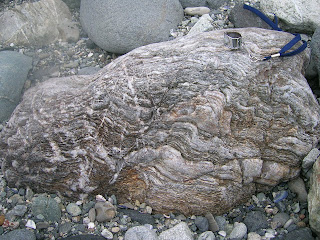
Seeing as all of the stuff in this breccia was spit out of a subduction zone, one would expect a bunch of spectacularly deformed metamorphic rocks. I thought this one was particularly awesome, since it has clearly been kicked back and forth between brittle and ductile zones several times. There are places where twisted and folded bands have been displaced across a clear break, but also places where a break with displacement across it has been twisted and folded in turn. It really is amazing how much can happen to one rock without its past history getting distorted beyond a point where it can be deciphered.
And that is it for this quarter's field trips. But I'm going on a week long fault-poking road trip next week (the Carrizo Plain is the longest stop on the itinerary), and I've been invited to go on some field trips for a class I'm not officially taking next quarter, so I am not doomed to spending too much time indoors!

The weather looked pretty threatening the entire time, but there fortunately was no actual rain.

This is a section of the breccia from Laguna Beach; the clay matrix is redder at Dana Point. Only reason I'm not posting one of those shots is I'm not sure whether or not my classmates would appreciate being in my blog, particularly if I'm only using them as scale.

The San Onofre formation is riddled with a bunch of little faults, like this one. We also saw two or three buildings - one of which is a popular restaurant - that are directly on top of some of said faults. They manifest pretty clearly, so one would think builders would shift stuff a few meters out of the way, but nope. Perhaps The O.C. is too cool for avoiding faults...

This fault had one of its sliding surfaces partly exposed, complete with weathered slickensides. Though my finger is ostensibly for scale, I also could not pass up the opportunity to take "fault poking" (my term for merely visiting faults) to a whole new level.

Some of these faults, as well as other cracks/fractures were healed up with calcite.

This is a narrow crevasse/groove that is developing a druse of calcite. (The dead bug is not for scale. The groove in question is about two inches wide and several feet long.) Apparently the mineralogy class goes on this trip every year, and this encrusting of crystals was not there last year.

Seeing as all of the stuff in this breccia was spit out of a subduction zone, one would expect a bunch of spectacularly deformed metamorphic rocks. I thought this one was particularly awesome, since it has clearly been kicked back and forth between brittle and ductile zones several times. There are places where twisted and folded bands have been displaced across a clear break, but also places where a break with displacement across it has been twisted and folded in turn. It really is amazing how much can happen to one rock without its past history getting distorted beyond a point where it can be deciphered.
And that is it for this quarter's field trips. But I'm going on a week long fault-poking road trip next week (the Carrizo Plain is the longest stop on the itinerary), and I've been invited to go on some field trips for a class I'm not officially taking next quarter, so I am not doomed to spending too much time indoors!
Tuesday, March 11, 2008
Shake Up != Wake Up
The Inland Empire apparently had three magnitude 3+ earthquakes on Sunday night. I felt none of them, which I find disappointing, since it's been almost three months since the last one I noticed. I'm sure I would have noticed them if I had been awake, since I tend to notice even the 2.9s, and since I felt two 3.9s from the same area (near Devore) in May. I literally just missed these three, though - I went to sleep fifteen minutes before they happened, and was too exhausted to be woken up, even by the magnitude 4.0. I suppose that finishing the draft of my thesis on Sunday should have been satisfaction enough to make me feel less disappointed about missing these, but such is not the case.
I'm particularly disappointed, though, that my computer wasn't running to catch these. I've been alpha testing the Quake-Catcher Network software since the beginning of February, and I have not yet had a chance to see how it picks up a genuine earthquake or three (as opposed to the motions caused by cats named after faults rocketing around my apartment). Also, by having one less of the alpha test computers running at the time (not that I know how many were running), that's less data with which to test the collecting and analyzing part of the QCN software. I know one computer isn't going to screw it up all by itself, but since I'm trying to help test this thing, I know my computer will be more useful if it was turned on to pick up quakes, even if I'm not awake to feel them. I'm hesitant to leave the computer running 24/7 for the sake of my hard drive, but I may have to just not think about that.
Looking at this little sequence (4.0, 3.4, 3.2) and one from 23 May 2007 (3.9, 3.9), both centered in pretty much the same place near Devore, I have to wonder if there's a small asperity in the fault there. In both sequences, all of the events happened within a couple of minutes - if not seconds - of each other, without many aftershocks later. I admittedly don't know enough about fault mechanics yet to tell whether or not my thought here can hold any water, but it seems at least possible that in these sets of events, the rupture could start, be briefly paused by the little asperity, then continue after stress makes the asperity give way. Does this actually make sense? Now that there have been two little sets of events there, I plan on reading more about that aspect of fault mechanics once I'm done with my comprehensive exams.
I'm particularly disappointed, though, that my computer wasn't running to catch these. I've been alpha testing the Quake-Catcher Network software since the beginning of February, and I have not yet had a chance to see how it picks up a genuine earthquake or three (as opposed to the motions caused by cats named after faults rocketing around my apartment). Also, by having one less of the alpha test computers running at the time (not that I know how many were running), that's less data with which to test the collecting and analyzing part of the QCN software. I know one computer isn't going to screw it up all by itself, but since I'm trying to help test this thing, I know my computer will be more useful if it was turned on to pick up quakes, even if I'm not awake to feel them. I'm hesitant to leave the computer running 24/7 for the sake of my hard drive, but I may have to just not think about that.
Looking at this little sequence (4.0, 3.4, 3.2) and one from 23 May 2007 (3.9, 3.9), both centered in pretty much the same place near Devore, I have to wonder if there's a small asperity in the fault there. In both sequences, all of the events happened within a couple of minutes - if not seconds - of each other, without many aftershocks later. I admittedly don't know enough about fault mechanics yet to tell whether or not my thought here can hold any water, but it seems at least possible that in these sets of events, the rupture could start, be briefly paused by the little asperity, then continue after stress makes the asperity give way. Does this actually make sense? Now that there have been two little sets of events there, I plan on reading more about that aspect of fault mechanics once I'm done with my comprehensive exams.
Wednesday, March 5, 2008
Danger danger danger!
Less than three hours after I posted lamenting how I have more photos of my car tempting the geological fates than of myself doing the same, the TA of my mineralogy class sent me this photo from this past weekend's trip to the San Onofre breccia at Dana Point, Orange County. (Entire entry about that trip coming soon.)

I laugh in your face, oh cautionary sign! How dare you try to thwart my efforts to poke the little bitty fault!

I laugh in your face, oh cautionary sign! How dare you try to thwart my efforts to poke the little bitty fault!
Off the freeway and into the fault trace...
I've really been enjoying reading all of the death-defying stories that have been posted around the geoblogosphere of late (though I hope it doesn't make me a bad person for enjoying accounts of dire peril from people I wouldn't want to see succumbing to that peril). It becomes quite evident that having a death wish, or at least not fearing death, comes with the territory of being a geologist. But then, does not having field experience with potential mortality attached inherently mark someone as a newbie to the field?
I think it does, at least in my case. The most "dangerous" thing I've done deliberately so far is park my car on a bunch of infamous faults. When I tell my friends in Virginia that I've done this, they get pretty freaked out; presumably, they don't understand how slim the odds of the fault rupturing in the few minutes my car is on it are. (And even if it were to go off while my car was there, I told them, if the car is parked, that would likely mean I would not be in it in the time, so the odds of me getting strike-slipped in half are even slimmer. They seemed moderately relieved.)

Here, we have a bad cameraphone photo of my car parked on the San Jacinto Fault in San Bernardino.

And here is my car on the San Andreas (with its convenient street sign), also in San Bernardino.

And this is my friend's car (which is the same model as mine, only darker gray), which she parked on the Calaveras Fault in Hollister, promptly after I said, "You'd better not park right on the fault."
But for this silliness, I did have a very serious very near death experience involving a car on the way to some geological activities. I was driving from Riverside to Soledad to meet a friend for a week-long road trip along the San Andreas. Just after getting off the terrifying California state route 46 and onto the apparently-safer US-101, strong wind shoved my car partway into the left lane. The problem was that another car was coming in that lane, so I corrected abruptly to avoid collision. I did, indeed, avoid a run-in with that car, but it turns out that I corrected too abruptly and ended up spinning off the freeway and rolling down a 15-foot embankment. I landed like this:

Amazingly, I had no injuries other than a pulled muscle in my neck, and we were still able to go on the road trip in my friend's car.
I think that any person would take stock of where they were in life and what they wanted to do with that chance to keep living after an incident like this. But chances are any sane person would think, "I nearly died heading to a geological site. Is this the safest thing for me to do with my life?" But me, I thought, "That road trip was the best thing I could have done after the accident. This really is what I want to study."
So there's hope for me yet in terms of geologically death-defying photographs.
I think it does, at least in my case. The most "dangerous" thing I've done deliberately so far is park my car on a bunch of infamous faults. When I tell my friends in Virginia that I've done this, they get pretty freaked out; presumably, they don't understand how slim the odds of the fault rupturing in the few minutes my car is on it are. (And even if it were to go off while my car was there, I told them, if the car is parked, that would likely mean I would not be in it in the time, so the odds of me getting strike-slipped in half are even slimmer. They seemed moderately relieved.)

Here, we have a bad cameraphone photo of my car parked on the San Jacinto Fault in San Bernardino.

And here is my car on the San Andreas (with its convenient street sign), also in San Bernardino.

And this is my friend's car (which is the same model as mine, only darker gray), which she parked on the Calaveras Fault in Hollister, promptly after I said, "You'd better not park right on the fault."
But for this silliness, I did have a very serious very near death experience involving a car on the way to some geological activities. I was driving from Riverside to Soledad to meet a friend for a week-long road trip along the San Andreas. Just after getting off the terrifying California state route 46 and onto the apparently-safer US-101, strong wind shoved my car partway into the left lane. The problem was that another car was coming in that lane, so I corrected abruptly to avoid collision. I did, indeed, avoid a run-in with that car, but it turns out that I corrected too abruptly and ended up spinning off the freeway and rolling down a 15-foot embankment. I landed like this:

Amazingly, I had no injuries other than a pulled muscle in my neck, and we were still able to go on the road trip in my friend's car.
I think that any person would take stock of where they were in life and what they wanted to do with that chance to keep living after an incident like this. But chances are any sane person would think, "I nearly died heading to a geological site. Is this the safest thing for me to do with my life?" But me, I thought, "That road trip was the best thing I could have done after the accident. This really is what I want to study."
So there's hope for me yet in terms of geologically death-defying photographs.
Subscribe to:
Posts (Atom)