I'm getting to a point where I'll gladly go see anything Brad Bird directs, no questions asked. The Iron Giant was awesome in and of itself, then The Incredibles was wonderfully clever and well-done, and I thought Ratatouille was one of the best in Pixar's whole illustrious lineup of films. Therefore, when I heard that Bird is going to be directing a live action film, with Pixar possibly stepping in to handle some of the special effects, I immediately counted myself in for a ticket even without knowing the release date. I was all the more excited to hear that the film in question is called 1906.
As in, The Great San Francisco Earthquake And Fire Of 1906.
Even if I hadn't been sold already, that would've done it.
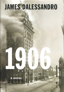
With no release date pinned on the film at the time (though it's since been slated for sometime in 2009), I figured I would check out the book on which the movie is to be based, James Dalessandro's 1906. It was a quick read - I was able to get through the whole thing on one cross-country flight. And, well. If anyone can fix it, I trust Brad Bird can.
The novel suffers from some problems that are unrelated to the geology of the characters' situation. For one, the main character/narrator is a definite Mary Sue: she knows everyone who's anyone in San Francisco, is involved investigating the mayor (even though she's only media), gets to be Caruso's personal tour guide, owns Jack London's old typewriter, and so on, all at the age of 23. Her cop/engineer/geologist-with-a-degree-from-Stanford boyfriend isn't really any better. There are also some problems with the first person perspective, since there are scenes described in vivid detail that there's no way the protagonist would have seen (I'm talking, scene on a train coming from Kansas, let alone scene in the bad guys' secret lair). The entire story is laced with very heavy-handed foreshadowing, to the point where I was thinking, "Alright already, just get to the stinkin' earthquake!" Sure, when you pick up a book or go to see a movie called 1906 with a picture of the burning Call Building as the cover/promotional artwork, you know the earthquake is going to be a major plot point, but I think there are ways such a story could be written so that the reader/viewer, when immersed in the world being presented, would still not see it coming at the precise time that it does. The unexpectedness of earthquakes is a large part of the terror in them, and Dalessandro completely does away with that aspect. Furthermore, none of the main characters behave like normal human beings when the earthquake finally does strike. It comes at a point where there is already conflict going on, and when the shaking ends, the conflict picks up exactly where it left off, as if nothing had happened. One would think that at least a couple of people in the situation would have been utterly freaked out enough by the city shaking down around them to forget what they'd been doing before, or at least lose their place, but nobody in the scene seems to even bat an eye. Maybe they read all the foreshadowing from earlier in the book.
But for these faults (har har), 1906 has a problem that makes it quite singular among disaster movies - it has too much science. You heard right. Dalessandro clearly researched the cultural climate of turn of the 20th century San Francisco - his setting is detailed and colorful and lines up with all the history books I've read about this event so far. And he clearly did some research on the science of earthquakes - there's even a scene where two picnickers on San Andreas Lake notices an alarming rate of preseismic slip along the fault. The problem is that Dalessandro didn't cross reference the two - that is, he didn't check to see how much of that science was known in 1906. Thus, you get characters who are part of the general nonscientific public talking openly about the San Andreas Fault by name, even though it wasn't named until Andrew Lawson's 1908 report on the 1906 event. And the scientifically-inclined characters describe the fault as a boundary between the Pacific and North American plates, a good sixty years before the theory of plate tectonics was presented. Not to mention that scene with the picnic at the fault - the reason the picnic is there is one of the people on it is a seismologist who is deliberately measuring slip on the fault, monitoring it closely due to its threat to the city in the days before the quake. There's nothing scientifically incorrect here. It's just all displaced in time by a matter of years or decades - a huge oversight indeed.
The character stuff, the reactions, and the foreshadowing are all things that I'm sure Brad Bird can fix, since he's apparently in the process of rewriting an earlier version of the script. His other movies are much more subtle in their foreshadowing, and the characters are all more realistic, multifaceted, flawed people (or robots, or rats). I just really hope it occurs to the movie team to check their science and update the script - or perhaps backdate it, as the case may be.
I still plan on seeing 1906 when it comes out. I'm sure it'll look awesome, since Pixar is, it has been recently announced, involved. The murder mystery/tale of scandal of the book is still intriguing, even with the all-too-perfect characters and all-too-obvious earthquake. If worse comes to worse, 1906 will be next in a long line of disaster movies that are so bad that they're funny, but I doubt that, since it is a Brad Bird movie. I'm really hoping I'll be pleasantly surprised, and will be able to enjoy the film in earnest, without having to snark at anachronism.
1906 on IMDB
You know, it would be fun if a bunch of geobloggers went to see this together. Yeah.
Sunday, March 23, 2008
Saturday, March 22, 2008
San Onofre Breccia
I've pretty much managed to describe the entire field trip over the course of a few other entries by now, but I've been saying I'd post pictures for three weeks now, and I'm only delivering now. Eesh!
The weather looked pretty threatening the entire time, but there fortunately was no actual rain.
This is a section of the breccia from Laguna Beach; the clay matrix is redder at Dana Point. Only reason I'm not posting one of those shots is I'm not sure whether or not my classmates would appreciate being in my blog, particularly if I'm only using them as scale.
The San Onofre formation is riddled with a bunch of little faults, like this one. We also saw two or three buildings - one of which is a popular restaurant - that are directly on top of some of said faults. They manifest pretty clearly, so one would think builders would shift stuff a few meters out of the way, but nope. Perhaps The O.C. is too cool for avoiding faults...
This fault had one of its sliding surfaces partly exposed, complete with weathered slickensides. Though my finger is ostensibly for scale, I also could not pass up the opportunity to take "fault poking" (my term for merely visiting faults) to a whole new level.
Some of these faults, as well as other cracks/fractures were healed up with calcite.
This is a narrow crevasse/groove that is developing a druse of calcite. (The dead bug is not for scale. The groove in question is about two inches wide and several feet long.) Apparently the mineralogy class goes on this trip every year, and this encrusting of crystals was not there last year.
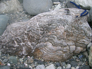
Seeing as all of the stuff in this breccia was spit out of a subduction zone, one would expect a bunch of spectacularly deformed metamorphic rocks. I thought this one was particularly awesome, since it has clearly been kicked back and forth between brittle and ductile zones several times. There are places where twisted and folded bands have been displaced across a clear break, but also places where a break with displacement across it has been twisted and folded in turn. It really is amazing how much can happen to one rock without its past history getting distorted beyond a point where it can be deciphered.
And that is it for this quarter's field trips. But I'm going on a week long fault-poking road trip next week (the Carrizo Plain is the longest stop on the itinerary), and I've been invited to go on some field trips for a class I'm not officially taking next quarter, so I am not doomed to spending too much time indoors!
Labels:
faults,
field trips,
local geology,
mineralogy,
photos
Tuesday, March 18, 2008
Not Easy Being Green
My internet connection was on the fritz all day yesterday, so I missed the best timing for posting a mysterious green deskcrop of my own. I'm still going to post it, though, since I'm not even entirely sure what it is. There was plenty of this stuff around at Dana Point Harbor, where my mineralogy class went for a field trip on 1 March. Even the professor wasn't sure what it was, so we collected some of it (and I very nearly spoiled the sample with blood after slicing my thumb on my knife trying to extract some of the green stuff) for analysis. I ran XRD on it, and one of my classmates put it under SEM...and we came up with completely unrelated results. My guess is the problem might have been in the preparation of the thin section for SEM, since this stuff has a hardness of less than two and powders so easily that I'm sure getting a clean even slice would be really difficult. We're going to put the powder we prepared for XRD into SEM after spring break, in hopes of clearing this up. But in the spirit of geopuzzles, I am consulting you guys, too! I'll let you know if your guess is what I came up with in XRD, or what my classmate came up with in SEM, though neither one is confirmed. I don't have any prizes to give, though I guess I could draw a silly picture for someone if they get it, or have a compelling argument for something other than what we tested.
There were a bunch of places where the mysterious soft green stuff appeared to form puddles in larger rocks.
In other places, the mysterious green mineral clearly followed the foliation of the rock; this was further supported when I was drilling out the green for the XRD sample - the drill bit went very deep into a tiny surface spot of material, but was still churning out green.
In terms of environment, Dana Point, in Orange County, is dominated by the San Onofre Breccia, which consists mainly of blueschists, with some greenschists and amphibolites, in a red clay matrix. Many of the rocks there show signs of being kicked back and forth between brittle and ductile parts of the subduction zone. I'll put a bunch more photos in the next post.
Labels:
deskcrop,
field trips,
geopuzzle,
mineralogy,
photos
Tuesday, March 11, 2008
Shake Up != Wake Up
The Inland Empire apparently had three magnitude 3+ earthquakes on Sunday night. I felt none of them, which I find disappointing, since it's been almost three months since the last one I noticed. I'm sure I would have noticed them if I had been awake, since I tend to notice even the 2.9s, and since I felt two 3.9s from the same area (near Devore) in May. I literally just missed these three, though - I went to sleep fifteen minutes before they happened, and was too exhausted to be woken up, even by the magnitude 4.0. I suppose that finishing the draft of my thesis on Sunday should have been satisfaction enough to make me feel less disappointed about missing these, but such is not the case.
I'm particularly disappointed, though, that my computer wasn't running to catch these. I've been alpha testing the Quake-Catcher Network software since the beginning of February, and I have not yet had a chance to see how it picks up a genuine earthquake or three (as opposed to the motions caused by cats named after faults rocketing around my apartment). Also, by having one less of the alpha test computers running at the time (not that I know how many were running), that's less data with which to test the collecting and analyzing part of the QCN software. I know one computer isn't going to screw it up all by itself, but since I'm trying to help test this thing, I know my computer will be more useful if it was turned on to pick up quakes, even if I'm not awake to feel them. I'm hesitant to leave the computer running 24/7 for the sake of my hard drive, but I may have to just not think about that.
Looking at this little sequence (4.0, 3.4, 3.2) and one from 23 May 2007 (3.9, 3.9), both centered in pretty much the same place near Devore, I have to wonder if there's a small asperity in the fault there. In both sequences, all of the events happened within a couple of minutes - if not seconds - of each other, without many aftershocks later. I admittedly don't know enough about fault mechanics yet to tell whether or not my thought here can hold any water, but it seems at least possible that in these sets of events, the rupture could start, be briefly paused by the little asperity, then continue after stress makes the asperity give way. Does this actually make sense? Now that there have been two little sets of events there, I plan on reading more about that aspect of fault mechanics once I'm done with my comprehensive exams.
Wednesday, March 5, 2008
Danger danger danger!
Less than three hours after I posted lamenting how I have more photos of my car tempting the geological fates than of myself doing the same, the TA of my mineralogy class sent me this photo from this past weekend's trip to the San Onofre breccia at Dana Point, Orange County. (Entire entry about that trip coming soon.)
I laugh in your face, oh cautionary sign! How dare you try to thwart my efforts to poke the little bitty fault!
Off the freeway and into the fault trace...
I've really been enjoying reading all of the death-defying stories that have been posted around the geoblogosphere of late (though I hope it doesn't make me a bad person for enjoying accounts of dire peril from people I wouldn't want to see succumbing to that peril). It becomes quite evident that having a death wish, or at least not fearing death, comes with the territory of being a geologist. But then, does not having field experience with potential mortality attached inherently mark someone as a newbie to the field?
I think it does, at least in my case. The most "dangerous" thing I've done deliberately so far is park my car on a bunch of infamous faults. When I tell my friends in Virginia that I've done this, they get pretty freaked out; presumably, they don't understand how slim the odds of the fault rupturing in the few minutes my car is on it are. (And even if it were to go off while my car was there, I told them, if the car is parked, that would likely mean I would not be in it in the time, so the odds of me getting strike-slipped in half are even slimmer. They seemed moderately relieved.)
Here, we have a bad cameraphone photo of my car parked on the San Jacinto Fault in San Bernardino.
And here is my car on the San Andreas (with its convenient street sign), also in San Bernardino.
And this is my friend's car (which is the same model as mine, only darker gray), which she parked on the Calaveras Fault in Hollister, promptly after I said, "You'd better not park right on the fault."
But for this silliness, I did have a very serious very near death experience involving a car on the way to some geological activities. I was driving from Riverside to Soledad to meet a friend for a week-long road trip along the San Andreas. Just after getting off the terrifying California state route 46 and onto the apparently-safer US-101, strong wind shoved my car partway into the left lane. The problem was that another car was coming in that lane, so I corrected abruptly to avoid collision. I did, indeed, avoid a run-in with that car, but it turns out that I corrected too abruptly and ended up spinning off the freeway and rolling down a 15-foot embankment. I landed like this:
Amazingly, I had no injuries other than a pulled muscle in my neck, and we were still able to go on the road trip in my friend's car.
I think that any person would take stock of where they were in life and what they wanted to do with that chance to keep living after an incident like this. But chances are any sane person would think, "I nearly died heading to a geological site. Is this the safest thing for me to do with my life?" But me, I thought, "That road trip was the best thing I could have done after the accident. This really is what I want to study."
So there's hope for me yet in terms of geologically death-defying photographs.
Sunday, March 2, 2008
Pacific Silica Quarry
I have neither died nor fallen into the ocean, though it kind of feels like the latter, considering how I feel like I'm frantically doggy-paddling to keep afloat in all the reading, composition, thesis writing, rehearsals, performances, and occasional field trips.
The field trips, of course, are the fun part. My mineralogy class has gone on two in the past week, to vastly different but equally interesting places. I'll address these in two separate photo-heavy posts.
Last week's trip was to Pacific Silica Quarry in Perris, California. It has been long abandoned in terms of industrial purposes, but it's still open to anyone who wants to traverse very uneven, cracked, muddy, and hilly roads (the TA drove - the professor seemed pretty terrified) in search of minerals. The quarry taps into what seems to be a pretty big granitic pegmatite (far far bigger than the ones I mentioned in the Box Springs - those were only a couple of inches wide). It has all of the expected minerals for such a formation, with the added bonus of large schorl tourmaline crystals cutting across the quartz and feldspar.
It also had some particularly interesting formations of biotite, in long narrow strips criscrossing the quartz and feldspar of the quarry walls in shapes that are reminiscent of Chinese calligraphy.
While there were a few assigned questions for the trip (mostly in the form of finding specific things and drawing them), a large portion of the time was allotted to simply looking around for interesting things. And, if I do say so myself, I think I did pretty well for finding interesting things. I found two big chunks of euhedral k-feldspar - neither is the entire crystal, but one has five very clear crystal faces, and the other has what appears to be an enormous carlsbad twin. I also found a piece of quartz with a bunch of angular impressions in it that were obviously caused by k-spar crystals growing up against the quartz. Nobody else found any feldspar samples comparable to these, so I felt pretty awesome about it. They are now sitting very proudly on my desk.
Here's the one with five clear faces. For some reason, though, it did not want to be photographed without blur.
And here's the one with the big twin. I haven't seen that narrow crystal face on any of the feldspar we've looked at in the lab.
This is the dented quartz. This picture shows only the biggest imprint, but there are a bunch of smaller ones on the underside of the sample.
Our TA found some tiny garnets on a piece of feldspar, and when we looked closer, we found a bunch more stuck in or next to the tourmaline. Though garnet is not weird for pegmatites, it apparently has not been documented in this particular pegmatite before - there was no mention of it on the USGS map we had for the site, and the professor said she hadn't come across mention of them after years of reading up on the area in preparation for taking mineralogy classes there. She encouraged us to contact the USGS about what we found. (I think she's a fantastic teacher, and stuff like this is one of the reasons. She gets students excited to find things, and holds up that what we do find is significant beyond the scope of a grade in a class.)
A non-mineralogical thing that made me excited about this site was the view. Standing at the top of the hill into which the quarry was blasted, one is afforded an amazing view, from the San Gabriel Mountains down to Mt. San Jacinto. It's a much wider and less-polluted view than from the Box Springs. I loved being able to follow the such long sections of the paths of the San Andreas and San Jacinto Faults by tracing my finger in the air along prominent features (complete with scribbly circle thing upon hitting Mt. San Gorgonio).
We also had excellent weather timing. It was clear the entire time we were poking around in the quarry, but started to drizzle as soon as we got back in the vehicle. Half an hour earlier and we might have missed the garnets, but it held out just as long as we needed.
Subscribe to:
Posts (Atom)